AMC AT Connector Trailhead
Appalachain Trail Corridor
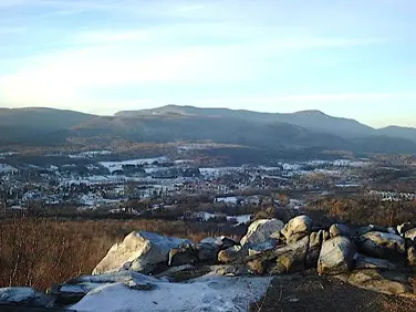
Mount Washington, MA
Snowshoeing | Hiking
Massachusetts Department of Conservation and Recreation
Appalachain Trail Corridor
Allowed Uses & Features
Information
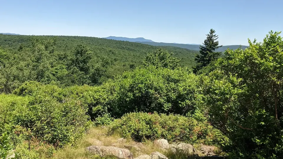
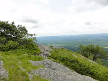
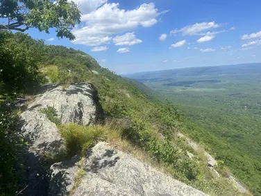
View from the Appalachian Trail
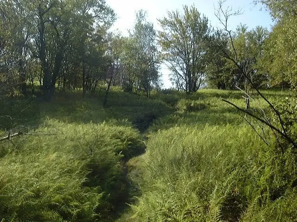
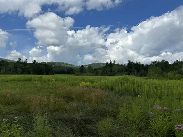
Grassy section of the Appalachian Trail
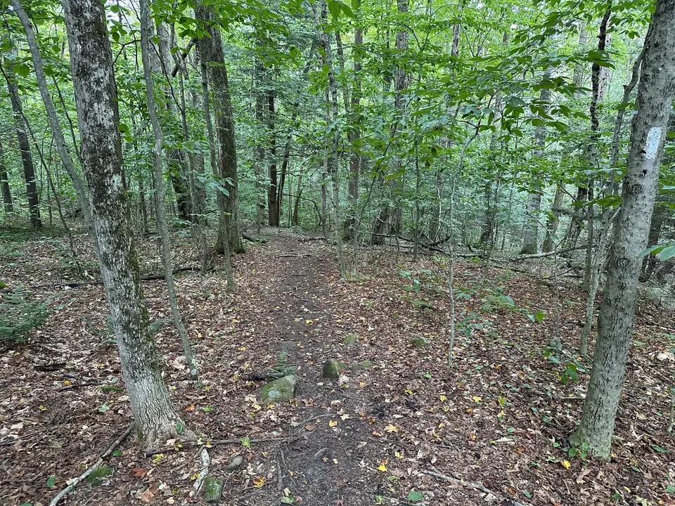
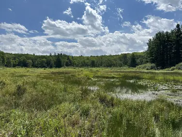
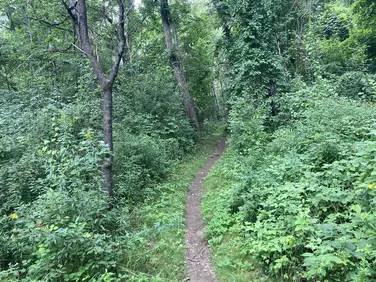
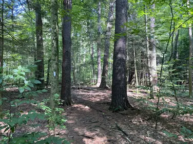
View of the Appalachian Trail running through a forest
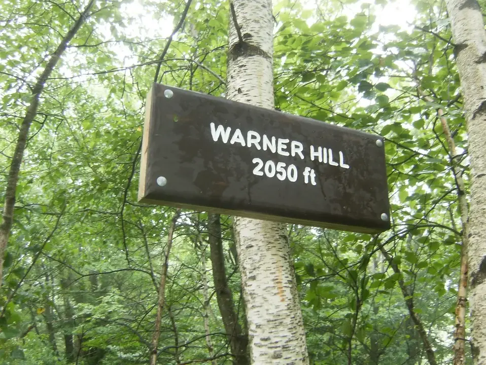
Warner Hill sign
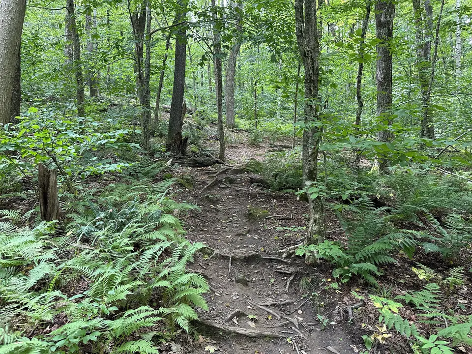
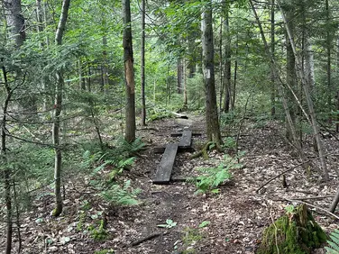
Rooted section of the Appalachian Trail running through some ferns

Berry bush located along the Appalachian Trail
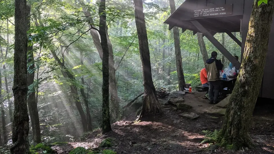
Kay Wood Shelter
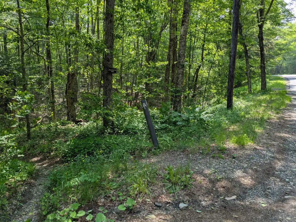
Entrance to the Appalachian Trail from the parking area on Grange Hall Road
Allowed Uses & Features
Information
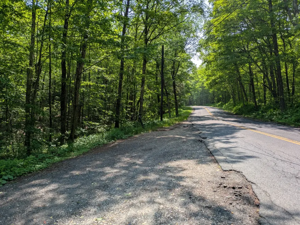
This popular trailhead is a jumping off point for a short hike to a nearby Appalachian Trail campsite, or a longer, all day hike to a prominent viewpoint. There is parking for 4-5 cars at the pull off on the north side of the road. Spotting a 2nd car near your destination at Blotz Road makes for a great one-way hike.
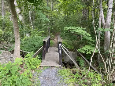
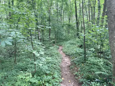
The Appalachian Trail crosses the road at the east end of the parking area. Turning left, northbound hikers descend to Barton Brook, crossing it on a wooden trail bridge before turning left, and continuing parallel to the stream through a shady ravine, thanks to a grove of hemlock trees. Eventually, the Trail turns away from the stream and climbs, steeply at times to the wooded summit of Day Mountain before descending, crossing some wet and muddy areas before arriving at railroad tracks and Housatonic St. Use caution crossing the tracks, trains are moving quickly from both directions.
Southbound A.T. hikers cross Grange Hall Road and begin a steady climb. A side trail is reached after about a half mile which leads to Kay Wood Shelter and campsite--a primitive overnight site for A.T. backpackers. Named after longtime Dalton resident and early A.T. volunteer, Kay Wood. Kay hiked all 2000 miles of the A.T. and led the effort to formally organize volunteers to maintain and manage the Trail in Mass. You can view a short biographical video about her life on YouTube.
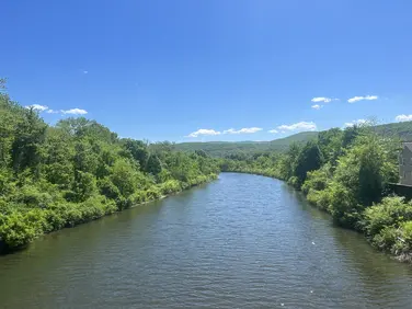
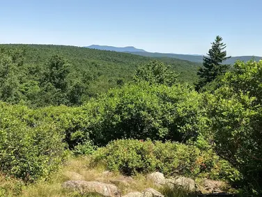
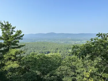
Continuing uphill past the side trail, the A.T. crosses a power line before once again climbing--more moderately this time--before reaching height of land. From there, continuing on a more level grade, hikers start a short climb through a field of ferns to the top of Warner Hill at 3.5 miles from Grange Hall Road. Warner Hill is an open summit crowded with high bush blueberry bushes--mid-July is prime picking season. There is an expansive view from the top, which includes Mt Greylock on the far horizon as well as glimpses of Pittsfield and Dalton in the middle ground. Sharp eyes can see the power line that was crossed near your starting point. A short 0.8 mile hike further south brings you to Blotz Road (also known as Kirchner Road).
The Appalachian Trail (or A.T.), is a 2100 mile footpath stretching from Maine to Georgia. 90 miles of the Trail are in Massachusetts, traversing the Berkshires. Local volunteers manage and maintain the footpath and the surrounding trail corridor in partnership with the Massachusetts Department of Conservation and Recreation (DCR) and the National Park Service Appalachian Trail Park (NPS-APPA). While popular with both day hikers and backpackers, the A.T. is managed as a primitive backcountry trail with limited amenities. Visitors should dress for the range of expected weather, wear sturdy shoes, and carry the Ten Essentials on their hike. Bicycles and motorized vehicles are not permitted on the A.T. For more on the Appalachian Trail, visit the Appalachian Trail Conservancy’s website.
Massachusetts Department of Conservation and Recreation
Appalachain Trail Corridor
Tell others about this place
The Appalachian Trail Trailhead at Grange Hall Road features a small parking area and a trail crossing. The parking area is hard-packed gravel that slopes down and is uneven. The trail entrances on both sides of Grange Hall Road are also very steep, rocky, and narrow. The Appalachian Trail is known as one of the most challenging trails in the United States. It is managed as a primitive backcountry trail with limited amenities, making trail conditions unpredictable. This section is frequently very steep and narrow, with the surrounding forest routinely encroaching upon the trail.
Parking area
Looking to meet up with others for team sports or group activities? Check out our list of clubs, guides and leagues in the Berkshires on the Resources page. Our list of summer camps will help you plan an overnight or day camp adventure for your young ones.
We also link to an array of outdoor recreation retail shops for gear and rental facilities for equipment on the Gear page.