AMC AT Connector Trailhead
Appalachain Trail Corridor
Mount Washington, MA
Snowshoeing | Hiking
Massachusetts Department of Conservation and Recreation
Appalachain Trail Corridor
Allowed Uses & Features
Information
Entrance to the parking area (right) for the AT trailhead at Lake Buel Road.
Allowed Uses & Features
Information
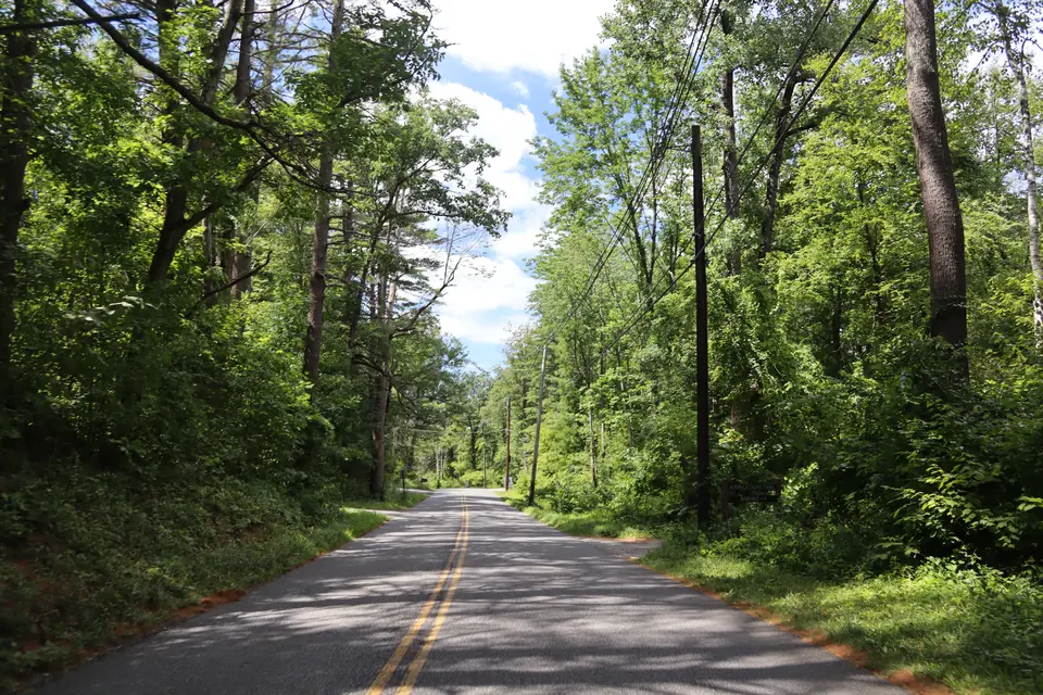
This small parking area has room for up to 6 cars, if carefully positioned. The A.T. crosses Lake Buel Road about 100 feet to the left from the parking area. Northbound hikers can spot a 2nd car at Monterey Road (Route 23) for an easy 0.8 mile trip on flat trail, or at Benedict Pond Boat Launch for a more strenuous 2.6 mile option to the junction of the Benedict Pond Loop Trail, then another 0.4 miles on the easy loop trail to the parking area. Southbound hikers can spot a car at Home Road for a strenuous 4.8 mile hike--or a much shorter 2.4 mile “out and back” round trip to Tom Leonard Shelter.
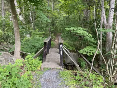
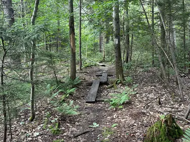
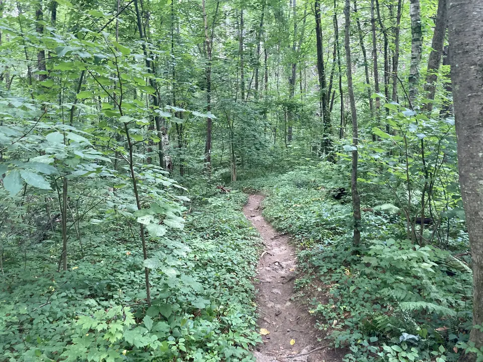
Northbound hikers turn left where the A.T. crosses Lake Buel Road, and descend on wood steps to a mostly level trail. Note that this area has Poison Ivy just about everywhere, so stay on the trail to avoid contact. The Trail soon crosses the remains of a dam above Lake Buel then through a section of Trail damaged by a tornado in 1990. Crossing Rt 23 (Monterey Road) at 0.8 miles. Hikers wishing to go further, follow the A.T. past the kiosk where the trail soon starts to climb, steeply at times, before reaching a flat area adjacent to a pasture. On bog bridges, the Trail reaches Blue Hill Road. Crossing the road, hikers scramble up a short rocky cliff before the Trail levels off and continues to the junction of the blue-blazed Benedict Pond Loop Trail. Turn left to follow this trail to the Benedict Pond Boat Launch parking area.
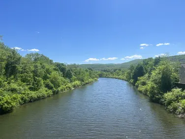
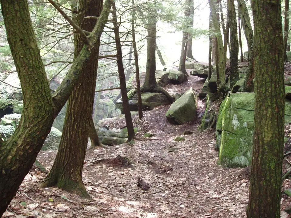
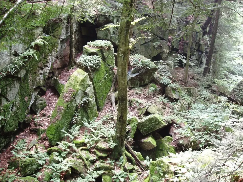
Southbound hikers cross Lake Buel Road and climb several wood steps, then continue uphill as the trail levels out slightly. Note that this area is extensively covered by Poison Ivy, stay on the footpath to avoid contact. As the Trail levels out, the Poison Ivy is left behind, and open woods are traversed with occasionally muddy areas. A small stream is crossed before the Trail reaches and ascends steeply alongside a cliff. The A.T. bends slowly right and views of Ice Gulch appear at about one mile. There are several overlooks of the Gulch, use caution. After snowy winters, ice can be found in the shaded places at the bottom of the Gulch well into summer.
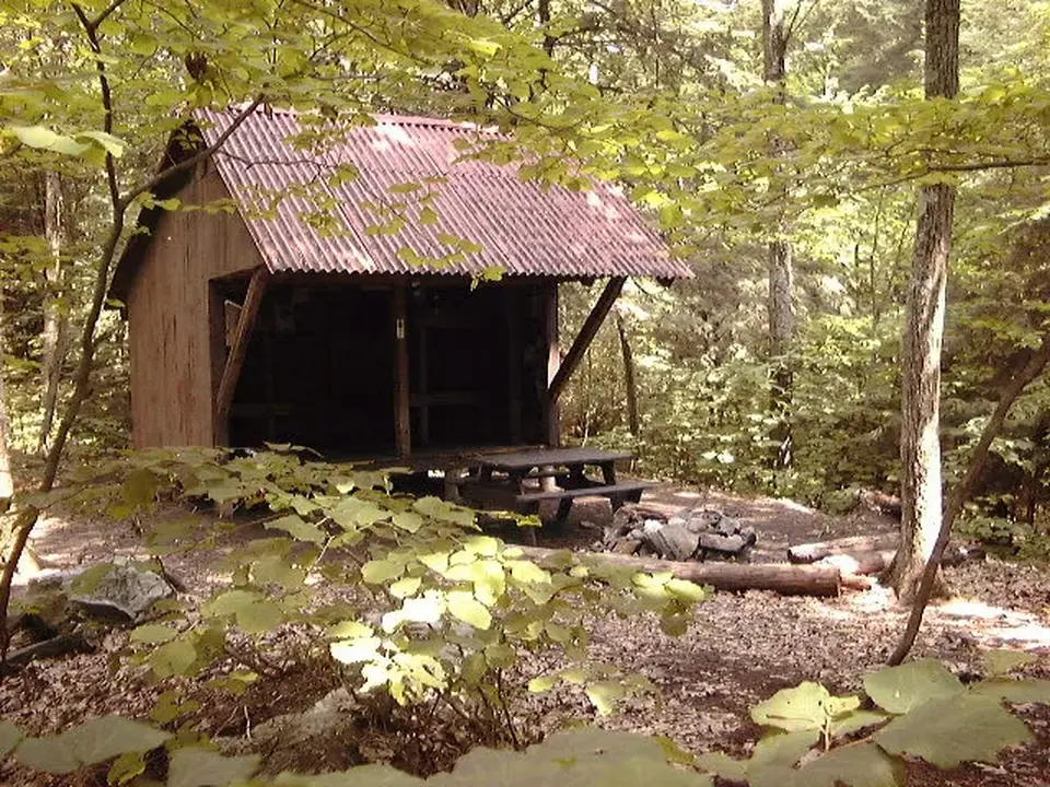
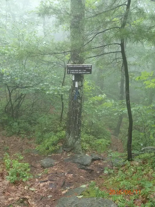
Topping out along Ice Gulch, the Trail turns away then skirts a moss covered cliff before turning sharply right through a cleft at the end of the cliff. Watch carefully for the white paint blazes that lead the way. Passing through the cleft, the trail descends briefly and signs point toward Tom Leonard Shelter and Campsite to the left at 2.2 miles, while the A.T. continues straight ahead, climbs brieful and crosses another blue blazed access trail back to the shelter. This is a primitive overnight site for A.T. backpackers, but there is an excellent view from a tent platform beyond the rocks in front of the shelter. Consult the map on the side of the shelter.
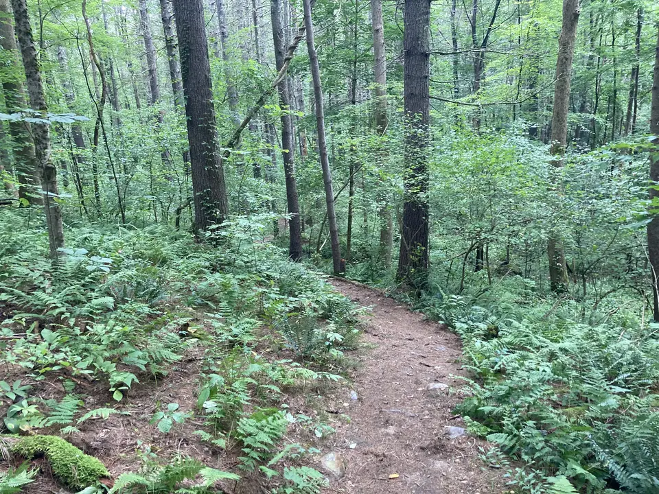
The A.T. continues southbound over rocky trail surrounded by mountain laurel. Blooming in late June, the laurel transforms the landscape with clusters of white and pink flowers. Approaching the west end of East Mountain, the Trail crosses an old woods road at 3.3 miles before descending slightly and turning right before traversing a rocky crevice. Climbing out of the crevice, a large smooth outcropping of bedrock at 3.8 miles makes for an excellent lunch stop with expansive views of the Taconic plateau to the west and south. The A.T. traverses nearly all the summits in the distance.
After the viewpoint, the Trail descends, steeply in places, and crossing open bedrock which can be slippery in wet weather. The Trail levels out through white pine forest before reaching Home Road in 4.8 miles.
The Appalachian Trail (or A.T.), is a 2100 mile footpath stretching from Maine to Georgia. 90 miles of the Trail are in Massachusetts, traversing the Berkshires. Local volunteers manage and maintain the footpath and the surrounding trail corridor in partnership with the Massachusetts Department of Conservation and Recreation (DCR) and the National Park Service Appalachian Trail Park (NPS-APPA). While popular with both day hikers and backpackers, the A.T. is managed as a primitive backcountry trail with limited amenities. Visitors should dress for the range of expected weather, wear sturdy shoes, and carry the Ten Essentials on their hike. Bicycles and motorized vehicles are not permitted on the A.T. For more on the Appalachian Trail, visit the Appalachian Trail Conservancy’s website.
Massachusetts Department of Conservation and Recreation
Appalachain Trail Corridor
Tell others about this place
Parking for the Appalachian Trail at Lake Buel Road is in a compact, slightly sloped parking area for at least 5 cars. The lot is comprised mainly of dirt. The trail can be accessed 75 feet south of the parking area, on both sides of Lake Buel Road. The northbound section of the trail steeply descends a staircase, while the southbound section steeply ascends a staircase into the trail.

Parking area for the AT trailhead at Lake Buel Road.

AT trail intersection with Lake Buel Road.
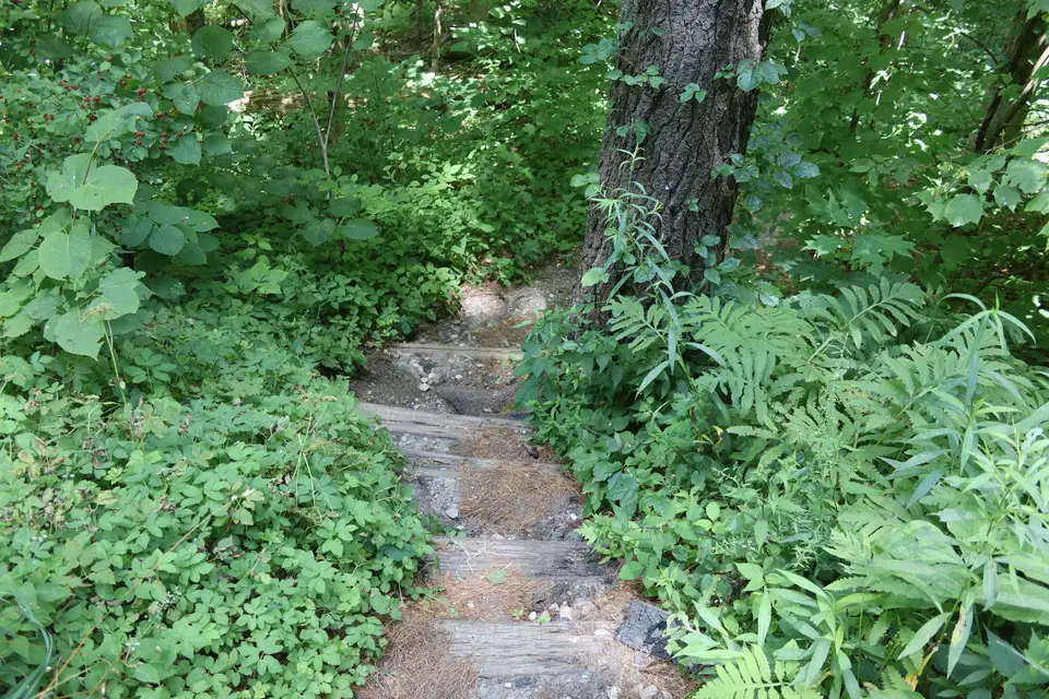
Start of the Appalachian Trail - Northbound, from Lake Buel Road.
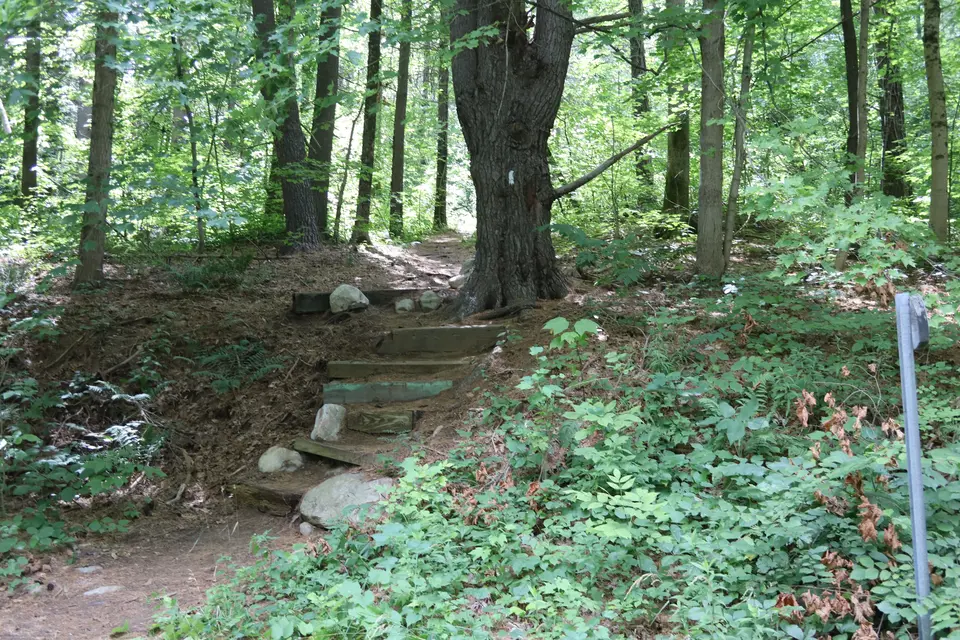
Start of the Appalachian Trail - Southbound, from Lake Buel Road.
Looking to meet up with others for team sports or group activities? Check out our list of clubs, guides and leagues in the Berkshires on the Resources page. Our list of summer camps will help you plan an overnight or day camp adventure for your young ones.
We also link to an array of outdoor recreation retail shops for gear and rental facilities for equipment on the Gear page.