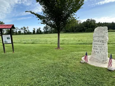
AMC AT Connector Trailhead
Appalachain Trail Corridor
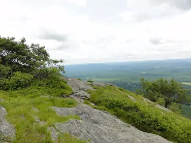
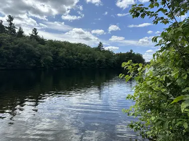
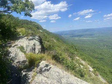
Mount Washington, MA
Snowshoeing | Hiking
Massachusetts Department of Conservation and Recreation
Appalachain Trail Corridor
Allowed Uses & Features
Information
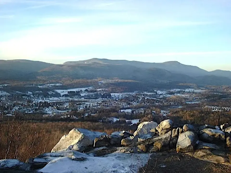
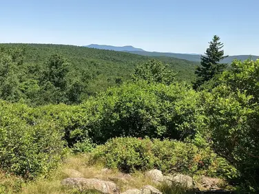
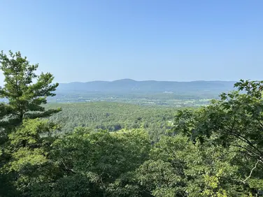
View of Dalton from a high point on the Appalachian Trail
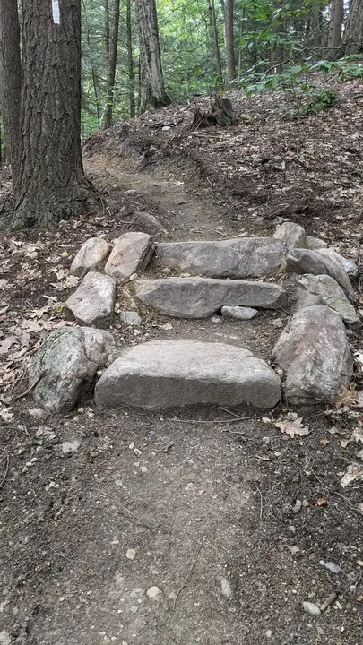
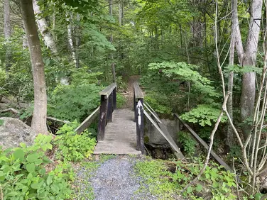
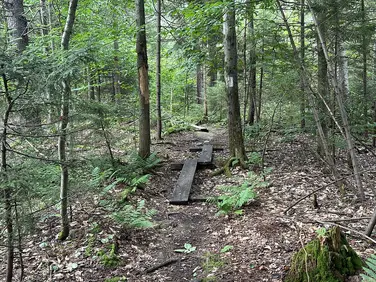
A set of stairs located along the Appalachian Trail near the Gulf Road trailhead
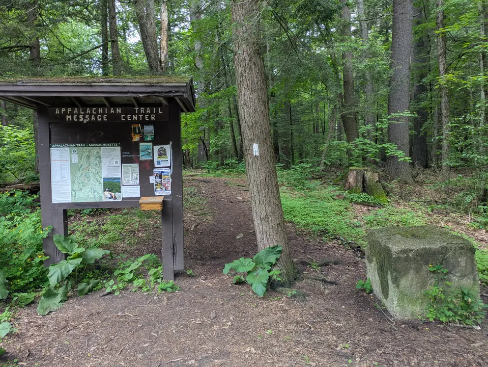
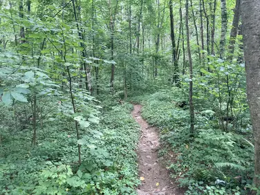
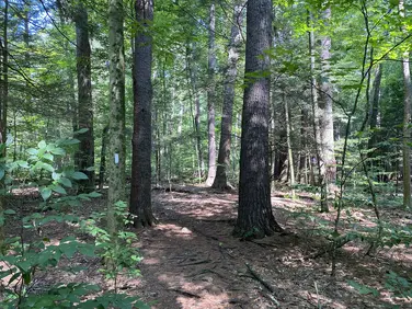
Trail entrance to the Appalachian Trail
Allowed Uses & Features
Information
Gulf Road in Dalton offers an easy walk through forest lands at the west end of Dalton. It is also the site of two adjacent trailheads. The Boulders offers several hiking and biking loops through open woods and open areas. The trailhead for the Appalachian Trail is right across the street and offers long distance and day hiking opportunities for visitors. It’s not often that two great outdoor opportunities are in such close proximity. Overnight parking is not recommended at this location. Like Cheshire, Dalton is one of a very few towns where the A.T. is on local streets. BRTA bus routes intersect the Trail near Route 8A. With a bit of planning, backpackers could take a 2 or 3 day overnight hike from North Adams to in Dalton (or vis versa).
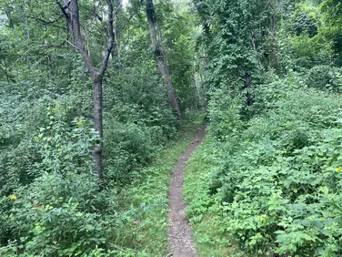
Northbound AT hikers leave from the west side of the parking area near the large A.T. kiosk. Following the white-painted blazes, the Trail traverses open woods under large hemlock trees climbing slightly. A sharp left turn takes the Trail off of an old woods road and onto a newly relocated (2022) section of trail for another ¼ mile before beginning a long climb 3.3 miles to Crystal Mountain Campsite, a primitive overnight site for backpackers. 7.7 miles will take hikers as far as Cheshire.
Southbound A.T. hikers go east on Gulf Road then High Street on town sidewalks for almost two miles, crossing Rt 8A, then turning right onto Depot Street before finally crossing Housatonic Street and the railroad tracks before entering the woods. Look for white-painted blazes on utility poles and AT medallions set into the concrete of the sidewalk on High Street. Use caution crossing the tracks, trains are traveling at high speed and come from both directions.
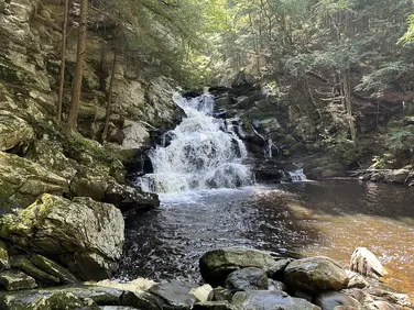
Once in the woods the Trail ascends the north side of wooded Day Mountain, before descending, steeply at times, to briefly follow Barton Brook. The area along the brook is cool and shady thanks to large hemlock trees. Climbing briefly again, Grange Hall Road is reached at 4 miles. Crossing the road, Kay Wood Shelter and campsite are reached in another 0.4 miles before the A.T. climbs North Mountain and points south.
The Appalachian Trail (or A.T.), is a 2100 mile footpath stretching from Maine to Georgia. 90 miles of the Trail are in Massachusetts, traversing the Berkshires. Local volunteers manage and maintain the footpath and the surrounding trail corridor in partnership with the Massachusetts Department of Conservation and Recreation (DCR) and the National Park Service Appalachian Trail Park (NPS-APPA). While popular with both day hikers and backpackers, the A.T. is managed as a primitive backcountry trail with limited amenities. Visitors should dress for the range of expected weather, wear sturdy shoes, and carry the Ten Essentials on their hike. Bicycles and motorized vehicles are not permitted on the A.T. For more on the Appalachian Trail, visit the Appalachian Trail Conservancy’s website.
Massachusetts Department of Conservation and Recreation
Appalachain Trail Corridor
Tell others about this place
Gulf Road in Dalton provides access to two trails, one being the Appalachian Trail. The parking lot at the trailhead has no formal accessible parking, but visitors can park right next to the trailhead. The parking lot is gravel and has variable conditions. Once in the parking lot, visitors will notice a tree and multiple concrete blocks by the trail access point, which narrows the access point. The first section of the trail, starting from the parking lot, is also very rocky and uneven. Visitors should note that the Appalachian Trail is managed as a primitive backcountry trail with limited amenities, making trail conditions unpredictable. This section of the Appalachian Trail is very narrow in places and can also become quite steep, with the trail routinely being rocky and uneven.

Tree and concrete block narrowing trail access point
Looking to meet up with others for team sports or group activities? Check out our list of clubs, guides and leagues in the Berkshires on the Resources page. Our list of summer camps will help you plan an overnight or day camp adventure for your young ones.
We also link to an array of outdoor recreation retail shops for gear and rental facilities for equipment on the Gear page.