AMC AT Connector Trailhead
Appalachain Trail Corridor
Mount Washington, MA
Snowshoeing | Hiking
Massachusetts Department of Conservation and Recreation
Appalachain Trail Corridor
Allowed Uses & Features
Information
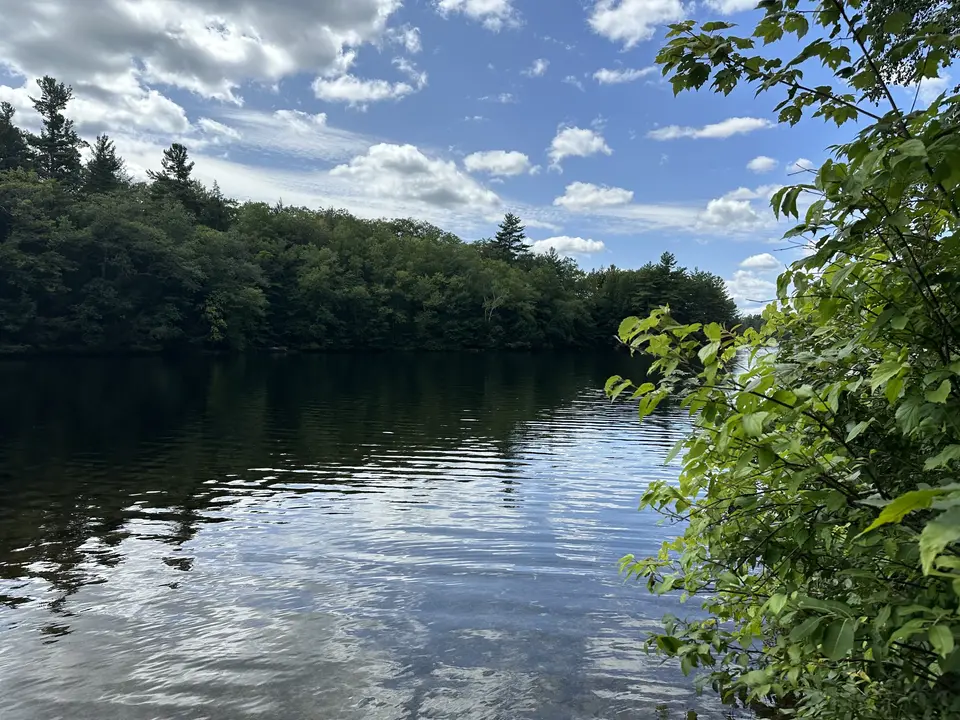
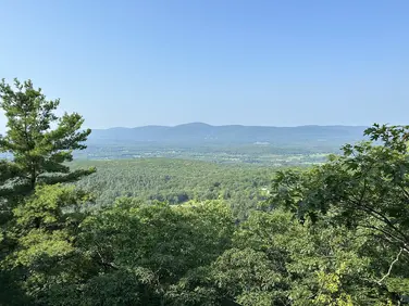
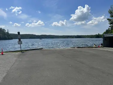
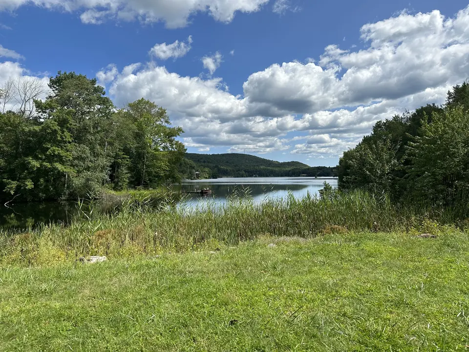
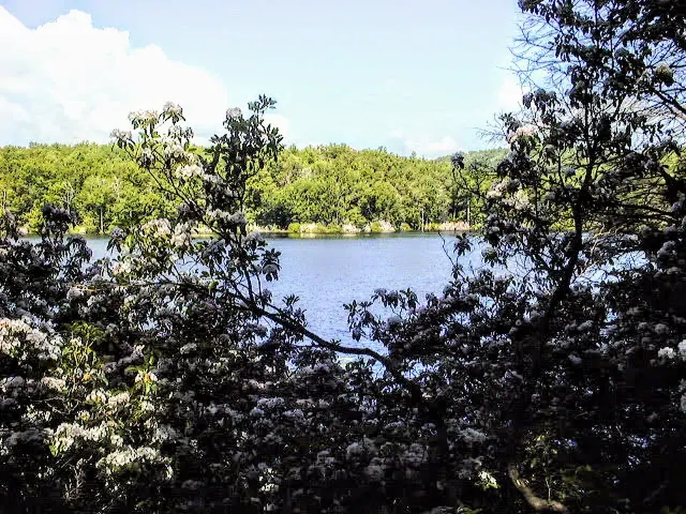
View of nearby Greenwater Pond.
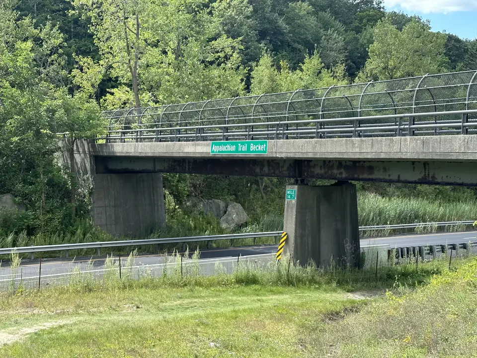
Appalachian trail crossing of Interstate 90.
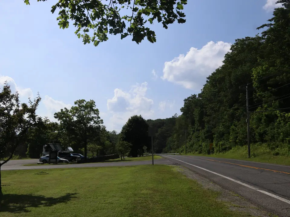
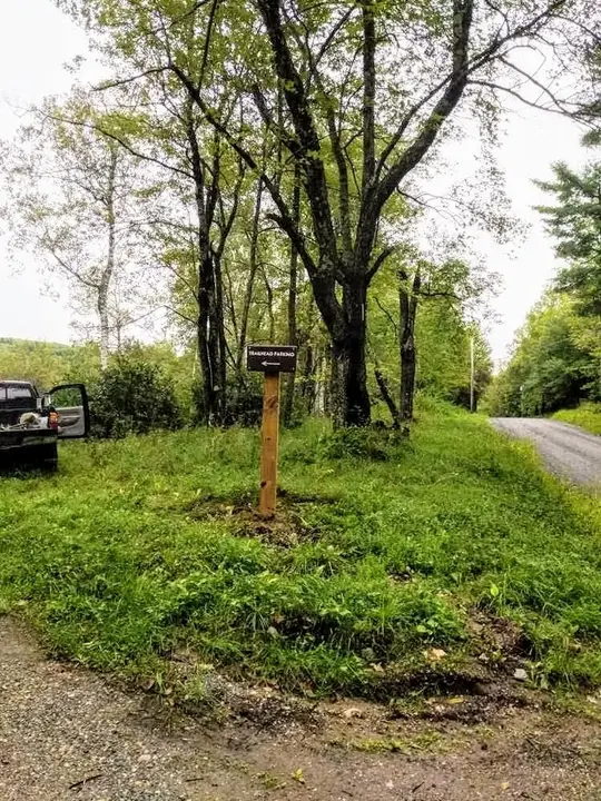
Parking for the Appalachian Trailhead at Jacobs Ladder (left) off Route 20.
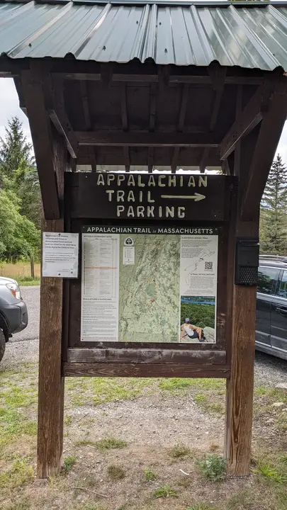
Map of the Appalachian Trail in Massachusetts, which can found in the parking lot.
Allowed Uses & Features
Information
This trailhead has parking for abut 10 vehicles. It is plowed in the winter. Northbound hikers can spot a 2nd car at County Road in Becket for a vigorous 4.1 mile hike. Southbound hikers can similarly spot a car at Goose Pond Road in Tyringham for an occasionally challenging 4.6 mile trip. The southbound route crosses the Mass Pike on the famous (to some) Appalachian Trail footbridge and also passes Upper Goose Pond Cabin, a cherished stopover for backpackers on the A.T., as well as a popular day hiking destination.
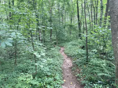
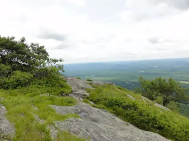
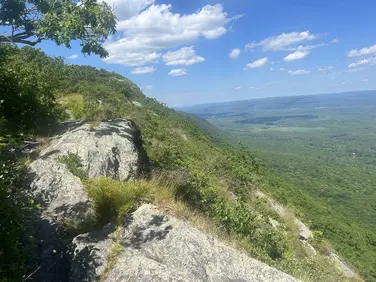
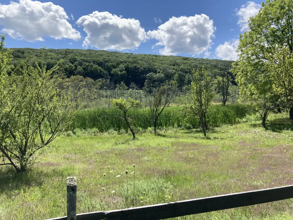
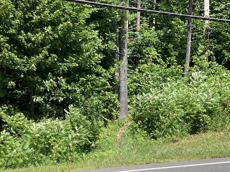
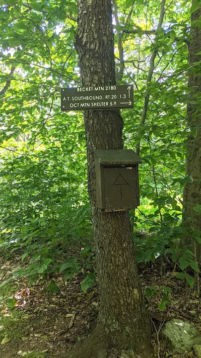
To access the northbound Appalachian Trail, hikers cross busy Rt 20 at the east end of the parking area onto a blue-blazed access trail that parallels the highway and reaches the A.T. in about 0.1 miles. A left turn takes hikers up Becket mountain on occasionally steep trail, crossing a power line, an unbridged stream and Tyne Road before reaching the wooded summit at the foundation of a former communication tower at 1.4 miles. The Trail turns sharply left, descends briefly before traversing the ridge of neighboring Walling Mountain before descending steeply to Finerty Pond at 2.8 miles. The pond is surrounded by mountain laurel, and is spectacular when in full bloom in late June. From the pond, the trail crosses the School House multi-use trail, and a number of beaver ponds before arriving at County Road at 4.1 miles. Overnight parking is not recommended at this trailhead.
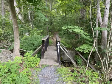
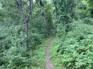
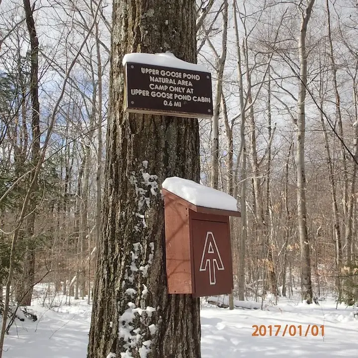
Southbound A.T. hikers can use the blue blaze access route noted above, then re-cross Route 20 on the A.T., or walk east along the highway guardrail until reaching the Trail. Use caution. Descending on steps from the highway, the Trail then crosses the outflow of nearby Greenwood Pond, before leaving the woods and hiking along the dam that forms the pond. Amid the roar of traffic, hikers climb the first of two spiral ramps accessing the footbridge that takes the A.T. across the Mass Pike (I-90). The bridge also serves as a route for snowmobiles in the winter. After crossing the upper bridge, theTrail turns briefly right, then sharply left, climbing continuously until reaching the boundary of the Goose Pond Natural Area 0.9 miles from the parking area. This area preserves the land surrounding Upper Goose Pond in an undeveloped state.
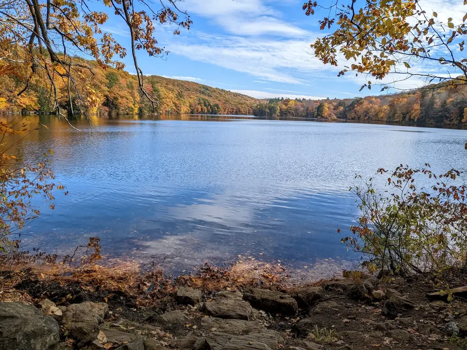
Descending, the trail reaches a junction with the ½ mile blue-blazed access trail to Upper Goose Pond Cabin at 1.6 miles. Managed for A.T. backpackers, the Cabin is a popular destination for day hikers too. Offering great swimming and views across the pond, it is staffed by volunteer caretakers 24/7 from mid-May to mid-October.
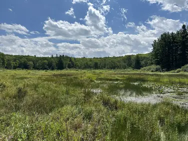
Passing the side trail, the A.T. skirts the northern shore of Upper Goose Pond before crossing Higgly Brook on a trail bridge. Trending away from the pond, the trail climbs the ridge to the south, often through abundant mountain laurel and leaving the Natural Area before arriving at Goose Pond Road at 5.3 miles. The parking area is 200 feet to the left of the Trail crossing.
The Appalachian Trail (or A.T.), is a 2100 mile footpath stretching from Maine to Georgia. 90 miles of the Trail are in Massachusetts, traversing the Berkshires. Local volunteers manage and maintain the footpath and the surrounding trail corridor in partnership with the Massachusetts Department of Conservation and Recreation (DCR) and the National Park Service Appalachian Trail Park (NPS-APPA). While popular with both day hikers and backpackers, the A.T. is managed as a primitive backcountry trail with limited amenities. Visitors should dress for the range of expected weather, wear sturdy shoes, and carry the Ten Essentials on their hike. Bicycles and motorized vehicles are not permitted on the A.T. For more on the Appalachian Trail, visit the Appalachian Trail Conservancy’s website.
Massachusetts Department of Conservation and Recreation
Appalachain Trail Corridor
Tell others about this place
The Appalachian Trail can be accessed by walking .25 miles eastward on Route 20. This section of Route 20 only contains a narrow shoulder to walk on for trailhead access. The nearby sections both north and southbound of the Appalachian Trail are moderately steep with consistent grades of 10-15% on both sides. Nearby trail access to Greenwater Pond is flatter but requires traversing a staircase. Parking for the Route 20 trailhead is a mix of dirt to grass, holding room for at least fifteen cars. One accessible parking space sits closest to Route 20. The parking area is flat with minimal grades.
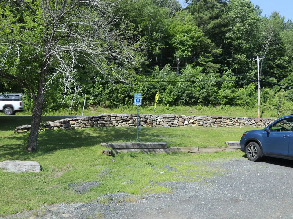
An accessible parking space which sits closest to access to Route 20.
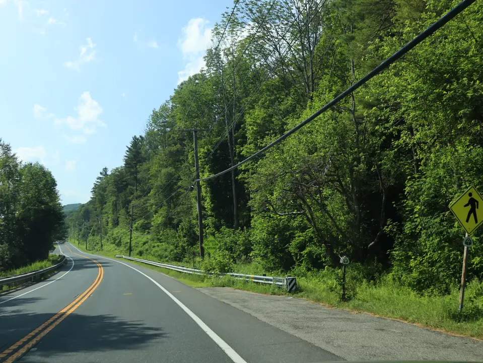
The section of Route 20 that is required to be traversed to access the Appalachian Trail. The trail can be shown on the bottom right.
Looking to meet up with others for team sports or group activities? Check out our list of clubs, guides and leagues in the Berkshires on the Resources page. Our list of summer camps will help you plan an overnight or day camp adventure for your young ones.
We also link to an array of outdoor recreation retail shops for gear and rental facilities for equipment on the Gear page.