AMC AT Connector Trailhead
Appalachain Trail Corridor
Mount Washington, MA
Snowshoeing | Hiking
Massachusetts Department of Conservation and Recreation
Appalachain Trail Corridor
Allowed Uses & Features
Information
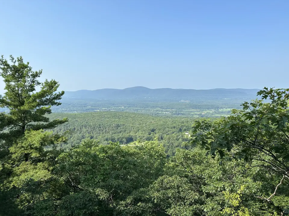
View towards the Taconic Mountains westward from East Mountain State Forest.
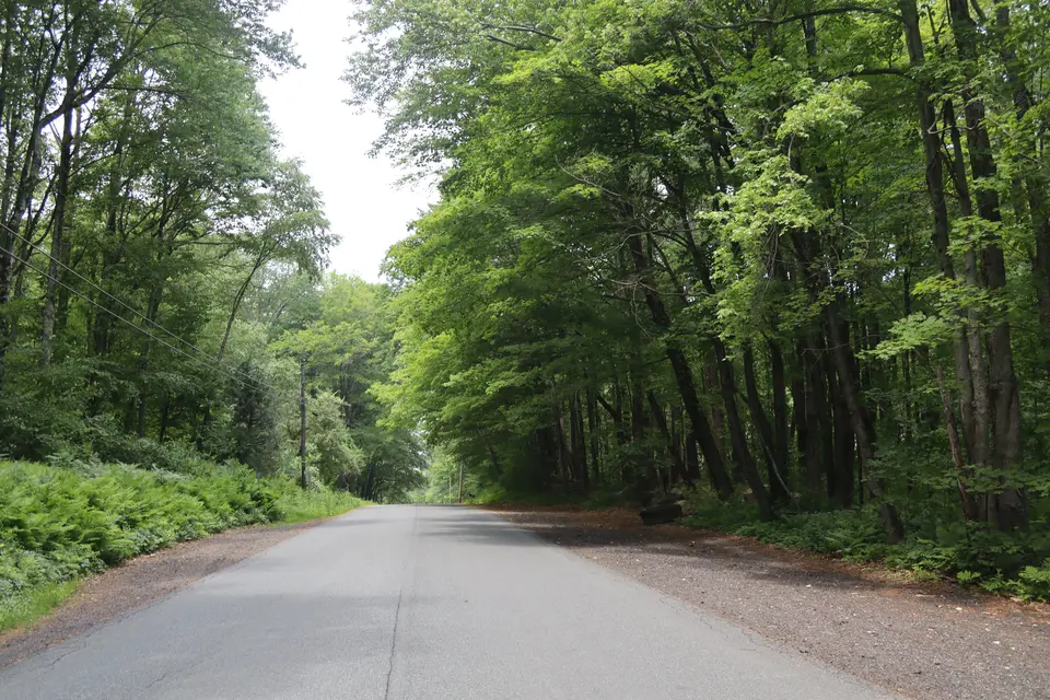
View of Home Road northbound at the Appalachian trail intersection, with avaliable parking on both sides of the road.
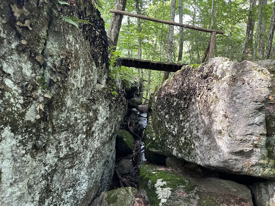
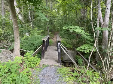
A wooden platform connects the Appalachian trail between two boulders near the Home Road trailhead.
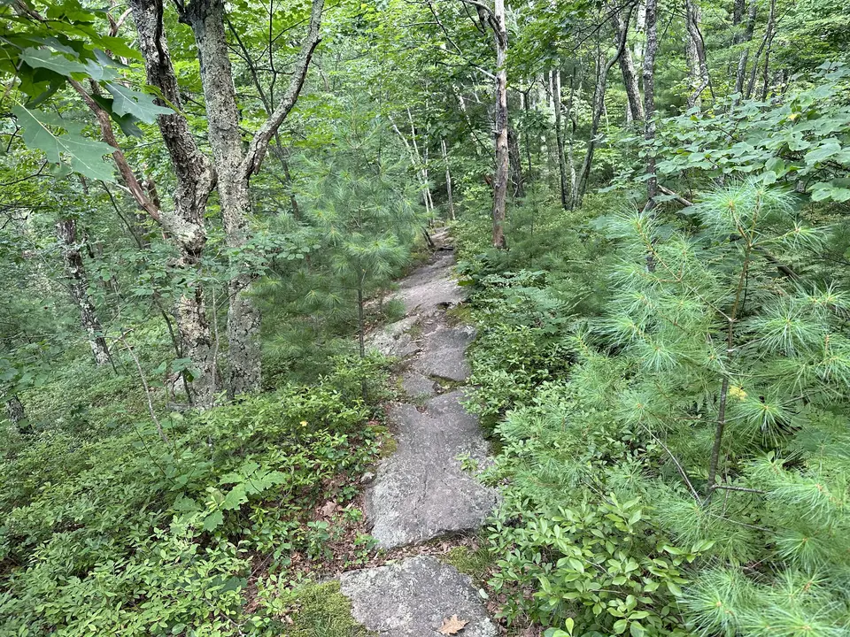
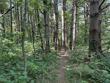
Pitch pine surrounds the Appalachian trail.
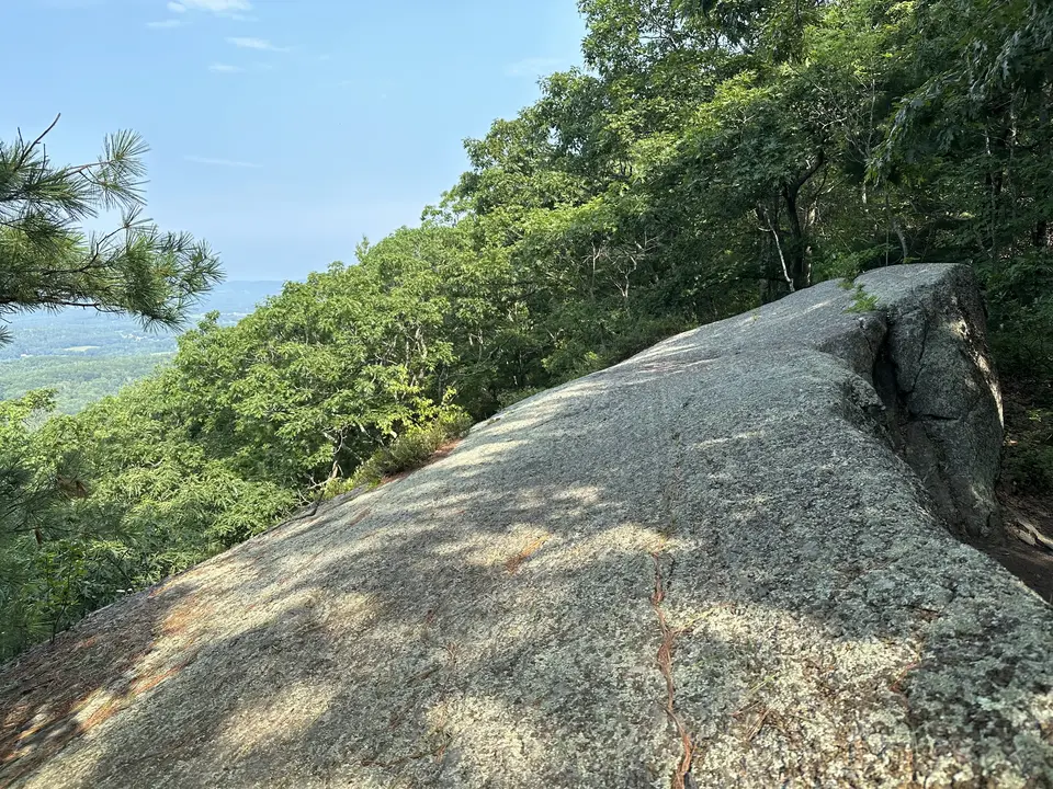
Minor rock scrambling in the East Mountain State Forest.
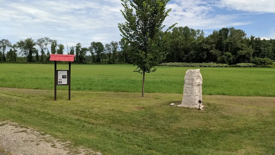
Shay's Rebellion Battle Site Monument, a few miles southward on the Appalachain Trail from Home Road.
Allowed Uses & Features
Information
This is a small, dirt pull out where the A.T. crosses Home road. Overnight parking is not recommended. Northbound hikers can spot a 2nd car at Lake Buel Road for a strenuous 4.8 mile hike, or a shorter 1 mile, but still strenuous, hike to a expansive viewpoint where the Taconics frame the western horizon and most of the southern Housatonic valley is spread out before you. Southbound hikers can enjoy an easier 4.6 mile hike through the fields and farmlands of the Housatonic valley to the trailhead at Sheffield Egremont Road and the Shays’ Rebellion monument.
Northbound hikers hike away from the road through a flat area dominated by large white pines before starting the steep climb to the high ground of East Mountain. The Trail scrambles up rock steps and smooth outcrops of bedrock that can be slippery when wet. Continuing to climb, the trail crosses a large crack in the side of the mountain then reaches the first (and probably most open) of several viewpoints along the top of this cliff at 1.0 mile. Continuing along the cliff edges, the A.T. goes in and out of a steep ravine before turning away from the cliff and crossing an old woods road. Climbing more easily now, the rocky trail continues to pass through areas of dense mountain laurel that blooms spectacularly in late June. Passing a signed, blue-blazed access trail to Tom Leonard Shelter and Campsite, the trail continues over a small knob before descending and crossing an intermittent stream near the second access trail. The shelter is visible on the left. A primitive overnight site for A.T. backpackers, it also features a nice south view from the tent platform behind the rock in front of the shelter. Consult the map on the side of the shelter for more info.
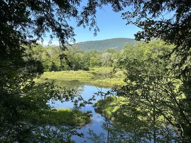
Past the shelter, the Trail climbs steeply to a narrow cleft and passes through to a broad ledge over Ice Gulch. Look closely for painted white blazes to guide your way. The A.T. parallels the edge of the Gulch offering several viewpoints down into this unique feature. Snow lingers at the bottom well into the summer. Descending along another cliff, the trail turns from the Gulch and traverses a wide, relatively flat area of open woods, crossing a small stream. Continuing through the woods with occasional muddy areas, the trail continues to descend to Lake Buel Road. Use caution, sight lines are limited to the left. The parking area is about 100 feet to the left on the opposite side of the road.
Southbound hikers cross Home Road, climbing easily to the rounded summit of June Mountain. Gradually, the Trail turns right and descends in steep sections before leveling out and crossing a small stream. Continuing steeply at times down the mountain the Trail meets the intersection of Boardman Street and Kellogg Road and crosses onto agricultural land on the right (north) side of Kellogg. On a mowed path along the edge of the field, the A.T. re-enters the woods briefly before coming back out onto Kellogg Road to cross the Housatonic River. Turning sharply right (watch for white blazes), the route travels briefly on a farm road before turning left to travel on the west bank of the Housatonic for more than a half mile. It crosses a long trail bridge, then turns sharply left before reaching US Route 7 at 2.8 miles. Use care crossing this busy highway.
After crossing Route 7, the A.T. diagonally traverses an open field, skirts the edge of a small pond, before turning left and mounting an old railbed that parallels the existing tracks of the Housatonic Railroad. Shortly, the Trail turns right and crosses the active tracks--use caution. Entering woods once again, the route enters a relatively young woods before crossing a swampy area on extensive boardwalk. The Trail climbs partway up the bank and parallels the swamp before crossing West Road at 3.5 miles . Climbing the opposite side of West Road, the Trail enters yet another field. On private land now, and granted a scenic easement by the owner, the Trail skirts the edge of the field and crosses a driveway before directly entering more woods and climbs into an area known as the Vossburg Hills--the site of lime kilns that were used in making iron in the late 1700’s and early 1800’s. Crossing another private driveway the trail enters yet another agricultural field and follows a mowed path along the edge before reaching a stone that memorializes the last battle of Shays’ Rebellion--a post-Independence uprising of farmers and war veterans against brutal economic practices. A small kiosk provides more information. The A.T. parking area is across Sheffield-Egremont Road from the monument at 4.6 miles.
The Appalachian Trail (or A.T.), is a 2100 mile footpath stretching from Maine to Georgia. 90 miles of the Trail are in Massachusetts, traversing the Berkshires. Local volunteers manage and maintain the footpath and the surrounding trail corridor in partnership with the Massachusetts Department of Conservation and Recreation (DCR) and the National Park Service Appalachian Trail Park (NPS-APPA). While popular with both day hikers and backpackers, the A.T. is managed as a primitive backcountry trail with limited amenities. Visitors should dress for the range of expected weather, wear sturdy shoes, and carry the Ten Essentials on their hike. Bicycles and motorized vehicles are not permitted on the A.T. For more on the Appalachian Trail, visit the Appalachian Trail Conservancy’s website.
Massachusetts Department of Conservation and Recreation
Appalachain Trail Corridor
Tell others about this place
The Appalachian Trail intersection with Home Road provides pull-offs on both sides of the road, providing gravel parking space for at least nine cars, with six spaces on the east side of Home Road and three spaces on the west side of Home Road. On the northbound side of the trail, a steep rocky ascent begins. The southbound side of the trail features a more moderate ascent before eventually flattening out after a 1.5-mile stretch.
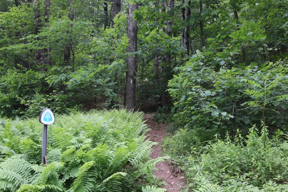
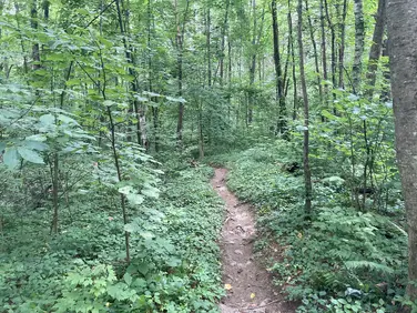
View of the Appalachian trail southbound from Home Road, which features a short acsent up June Mountain before flattening out.
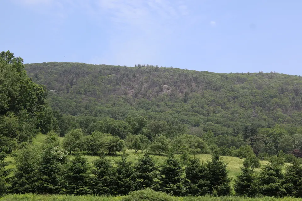
View of East Mountain from Home Road, just before the trail intersection. The Appalachian trail northbound from Home Road ascends this steep mountain.
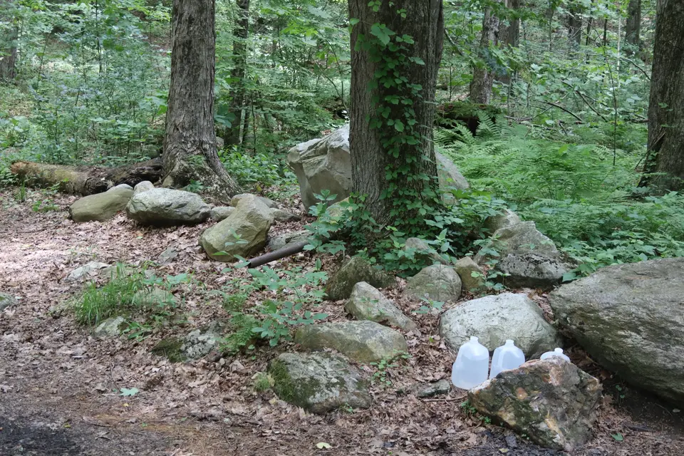
A small designated area holds water jugs for thru hikers on the northbound side of the trail intersection.
Looking to meet up with others for team sports or group activities? Check out our list of clubs, guides and leagues in the Berkshires on the Resources page. Our list of summer camps will help you plan an overnight or day camp adventure for your young ones.
We also link to an array of outdoor recreation retail shops for gear and rental facilities for equipment on the Gear page.