AMC AT Connector Trailhead
Appalachain Trail Corridor
Mount Washington, MA
Snowshoeing | Hiking
Massachusetts Department of Conservation and Recreation
Appalachain Trail Corridor
Allowed Uses & Features
Information
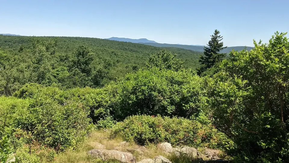
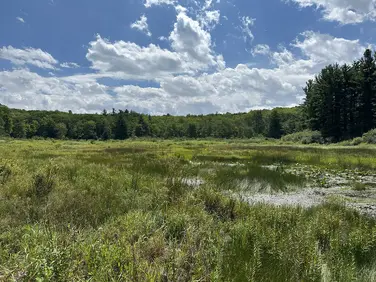
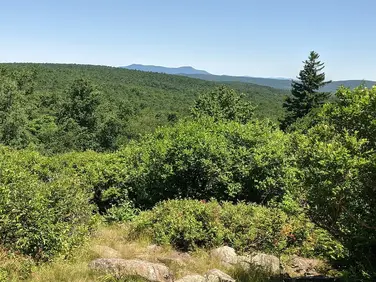
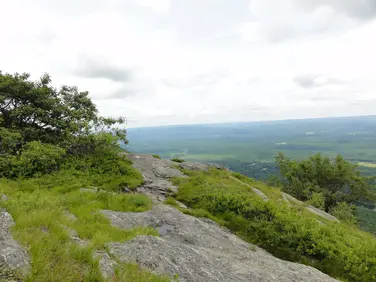
View from the Appalachian Trail
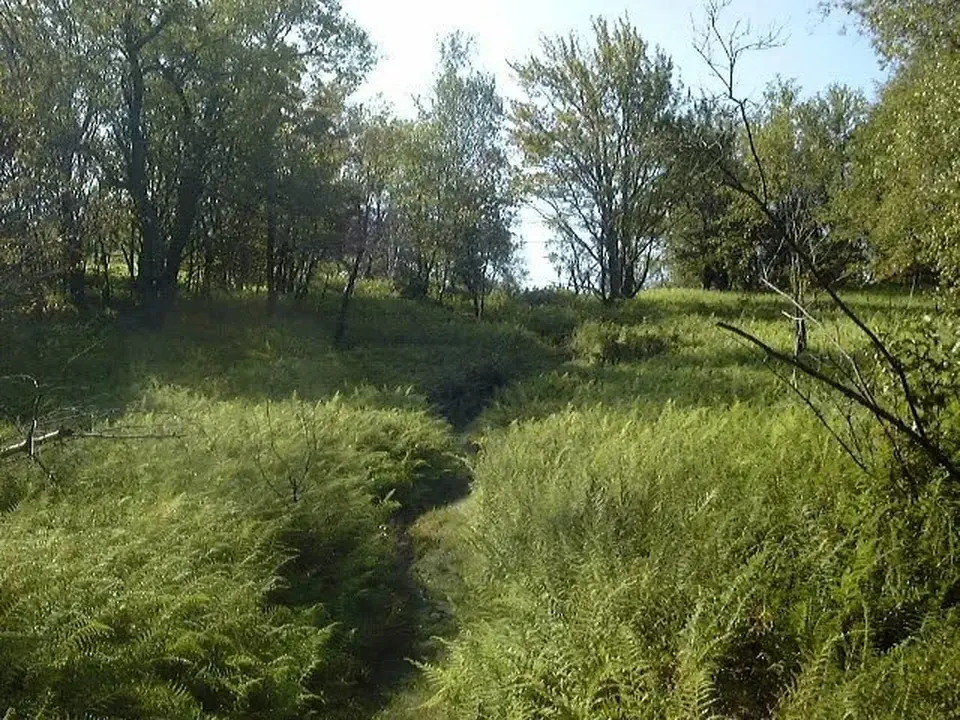
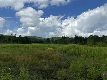
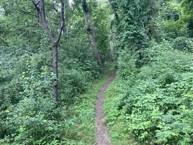
View of the Appalachian Trail as it runs through a grass meadow
View from the Appalachian Trail
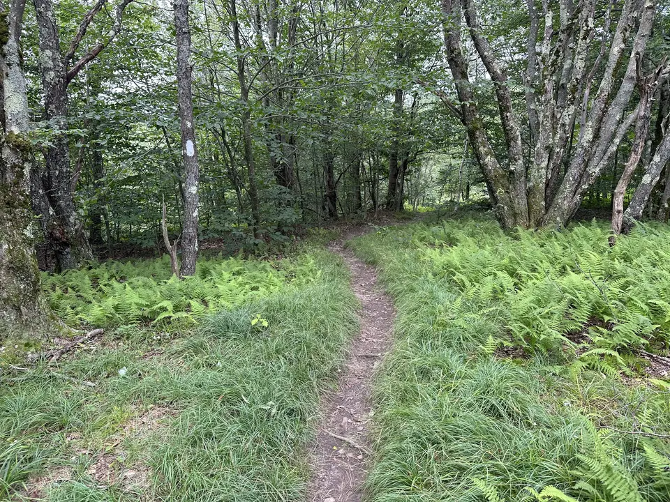
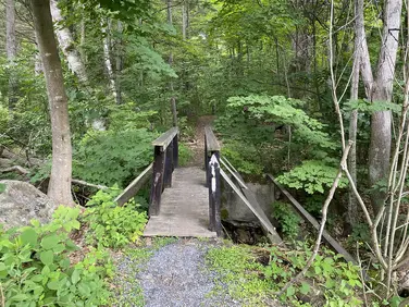
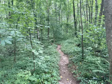
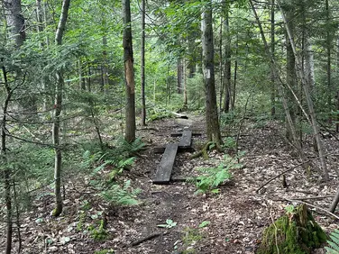
View of the Appalachian Trail as it runs through a forest
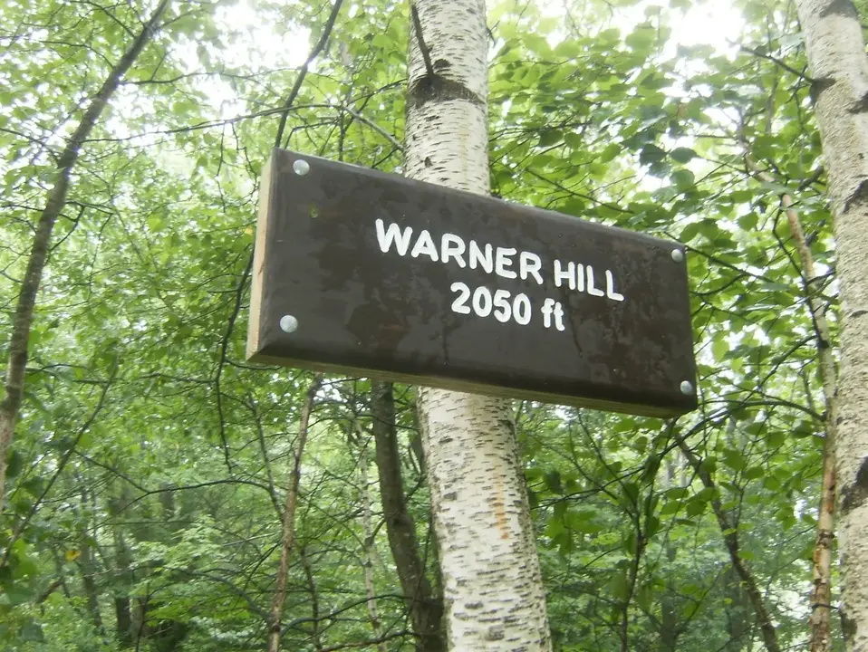
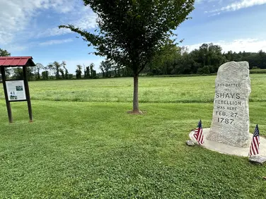
Warner Hill sign located along the Appalachian Trail
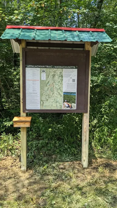
Informational sign located along the Appalachian Trail
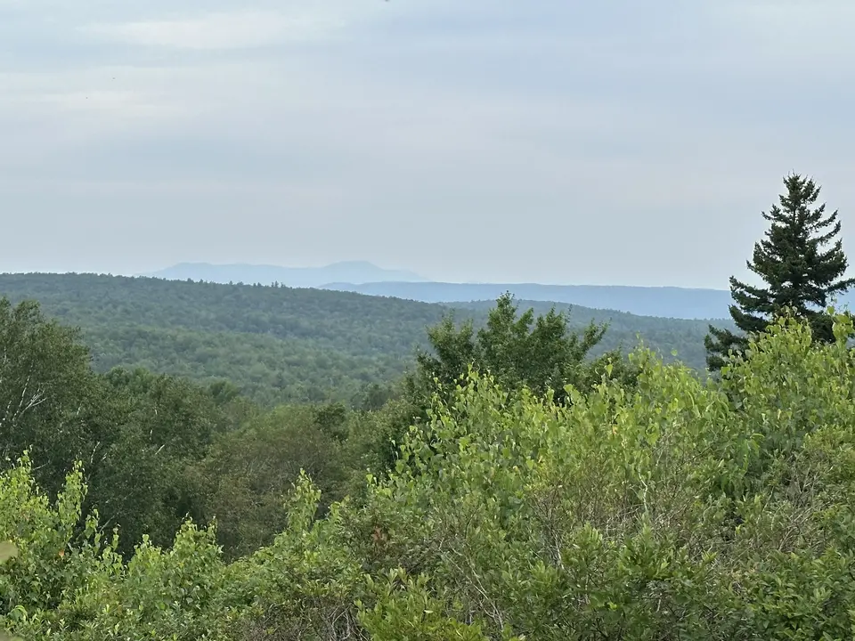
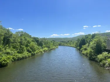
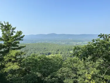
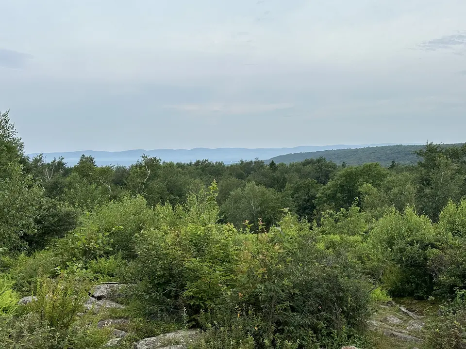
View from the Appalachian Trail
Allowed Uses & Features
Information
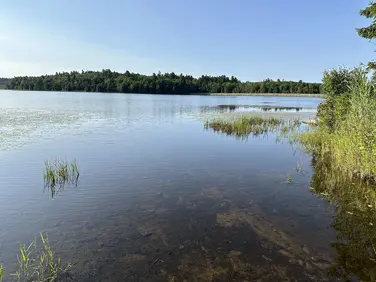
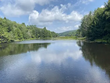
Also known as Kirchner Road, this trailhead has parking for about 8 vehicles. It is plowed in the winter, and provides year-round access to nearby Warner Hill--offering great views of Mt Greylock to the north--as well as abundant high bush blueberries in mid-July. Southbound hikers can spot a 2nd car near their destination at Washington Mountain Road for a great, relatively gentle 2.8-mile one-way hike--or for a 3.4-mile northbound hike, a car at Grange Hall Road.
The Appalachian Trail crosses through the center of the parking area. Starting away from the road, northbound hikers travel on a flat old woods road before climbing moderately through the remains of a Norway Spruce plantation. Originally planted around 100 years ago to protect heavily logged municipal watershed lands from erosion, these fast-growing, non-native trees are dying out and slowly being replaced by native species. Hikers can see where many fallen trees have been cleared from the Trail by volunteers. At two other locations on the AT, hikers can observe areas where the dying trees have been deliberately removed to speed the growth of native forests.
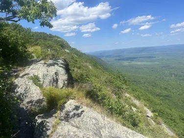
Leaving the plantation area, the Trail levels out through overgrown pastures before climbing moderately for a short distance through lush ferns to the summit of Warner Hill at 0.8 miles. The Mount Greylock range marks the far northern horizon, but the view includes the Taconics to the west and the southern parts of the Green Mountains to the northeast. Hikers can continue north on the A.T. to Grange Hall Road in Dalton for another 3.4 miles.
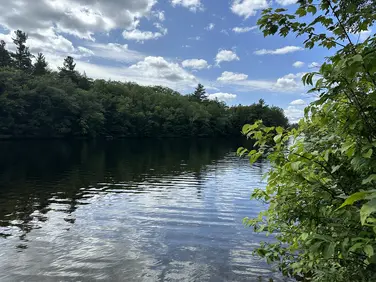
Southbound A.T. hikers cross Blotz Road and immediately walk on split logs (puncheon) or wood planks (bog bridges) over wet and muddy ground. The Trail climbs up and down three small high points for about 0.6 miles before arriving at a small cliff. The rocky nooks and crannies provide locations for porcupine dens--many tracks are observable in the winter as these critters travel between their dens and nearby hemlock trees--their favorite winter food. Scrambling down the cliff, it’s a short distance to Cady Brook. This unbridged stream crossing can be a bit tricky in times of high water, but a dry-footed crossing on rocks is possible most of the year. Upstream (right), hikers will see the remains of extensive beaver ponds. Climbing slightly, the A.T. enters Pittsfield Watershed lands. This extensive, generally flat area is often wet and crossed by several streams. Abundant bog bridges keep hikers above the wettest areas. Use caution as these can be slippery, especially when wet. As the ground gently rises, hikers reach Washington Mountain Road (also known as Pittsfield Road) in 2.8 miles. If you missed the wild blueberries on Warner Hill, you can pick your own in season at Blueberry Hill Farm (known to hikers as The Cookie Lady’s) about 300 feet left down the paved road.
The Appalachian Trail (or A.T.), is a 2100 mile footpath stretching from Maine to Georgia. 90 miles of the Trail are in Massachusetts, traversing the Berkshires. Local volunteers manage and maintain the footpath and the surrounding trail corridor in partnership with the Massachusetts Department of Conservation and Recreation (DCR) and the National Park Service Appalachian Trail Park (NPS-APPA). While popular with both day hikers and backpackers, the A.T. is managed as a primitive backcountry trail with limited amenities. Visitors should dress for the range of expected weather, wear sturdy shoes, and carry the Ten Essentials on their hike. Bicycles and motorized vehicles are not permitted on the A.T. For more on the Appalachian Trail, visit the Appalachian Trail Conservancy’s website.
Massachusetts Department of Conservation and Recreation
Appalachain Trail Corridor
Tell others about this place
The parking area off Boltz Road is a flat, gravel parking area with no accessible parking spaces; however, visitors can park right next to the trailhead. There are two Appalachian Trail access points from the parking area: one located near the parking area and the other across Boltz Road from the parking area. The access point, located right by the parking area, is 2 feet wide, as there is a stump in the middle of the trail. The trail leading from this access point is around 3 feet wide and overgrown, with the surrounding forest encroaching on the trail. Across the street is the second access point. From this access point, visitors must walk across a set of boardwalks; these boardwalks are between 8 to 12 inches wide with 6-inch gaps between each boardwalk. Once across the boardwalks, the trail conditions become variable, with some sections being soft and prone to mud while others are rocky and rooted. These factors can make accessibility difficult for some visitors. The Appalachian Trail is known as one of the most challenging trails in the United States. It is managed as a primitive backcountry trail with limited amenities, making trail conditions unpredictable and accessibility challenging.
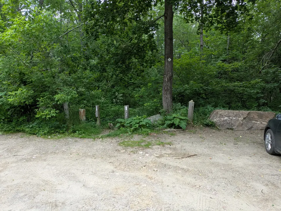
Parking area and trail entrance
Looking to meet up with others for team sports or group activities? Check out our list of clubs, guides and leagues in the Berkshires on the Resources page. Our list of summer camps will help you plan an overnight or day camp adventure for your young ones.
We also link to an array of outdoor recreation retail shops for gear and rental facilities for equipment on the Gear page.