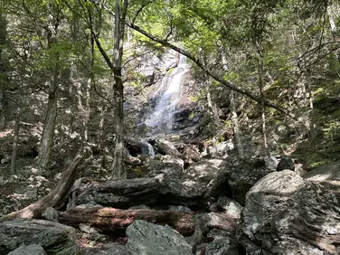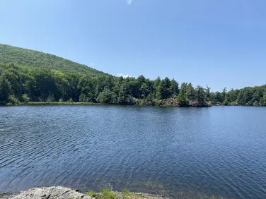
Guilder Pond
Mount Everett State Reservation
Mount Washington, MA
Cross-Country Skiing | Canoe/Kayak/SUP | Birding
Massachusetts Department of Conservation and Recreation
Mount Everett State Reservation
Allowed Uses & Features
Information
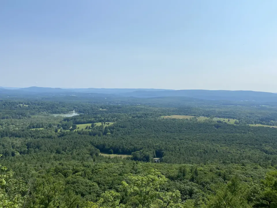
View facing eastward of the Berkshires.

The Appalachian trail intersects with Jug End Road. An pull off area with space for a few cars to park can be seen to the left.
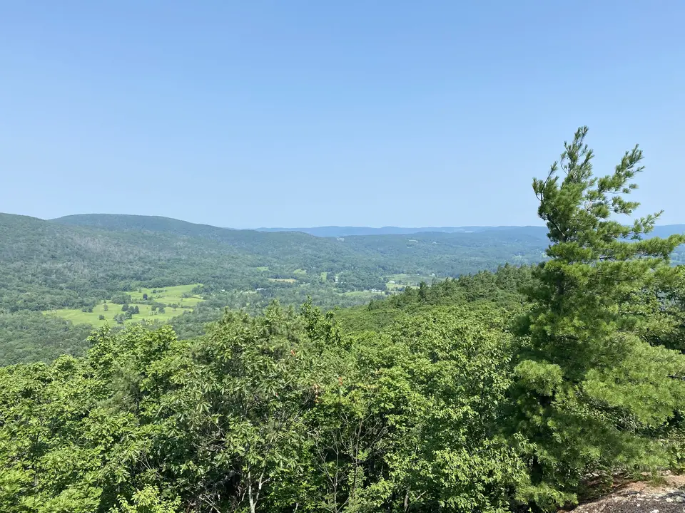
View of the Taconic Mountains to the northwest.
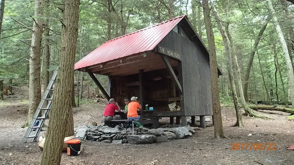
The Hemlocks Shelter, located on the Mount Everett State Reservation, roughly 4 miles south of the trailhead.
Allowed Uses & Features
Information
Also known as Guilder Hollow Road, this unofficial and un-marked (put popular) parking area is a pull off of the west side of Jug End Road and holds about six vehicles. Please park responsibly. This trailhead offers two distinct hiking experiences. Northbound, the Trail is essentially flat for almost 6 miles to Boardman Street in Great Barrington. Hikers can spot a 2nd car at Sheffield Egremont Road, for an easy 2.7 mile hike. Southbound hikers face a challenging climb up to a spectacular overlook, then south on a long ridge walk over 4 miles of rugged trail to Guilder Pond Parking on Mt Everett.
Northbound hikers cross to the opposite side of the road and enter a pine forest on generally flat trail. Entering an open field on a mowed path hikers reach Rt 41 (Undermountain Road) at 0.9 miles. The headquarters of Greenagers (a youth-centered outdoor education organization) is to the left approx 300 feet. Parking options are available on their campus. Continuing across Rt 41, the Trail descends slightly, crosses a small stream and ascends a short ridge in a shady forest dominated by white pine and hemlock. Descending to a wooded swamp, the Trail proceeds on bog bridges and short trail bridges over several streams before reaching Hubbard Brook, spanned by a large footbridge. Long distance hikers note that this stretch often has the worst mosquitoes on the entire Appalachian Trail. Be prepared with bug repellant and a head net. After crossing the brook, the A.T. continues on boardwalk and more bog bridges before arriving at Sheffield-Egremont Road and the Shays’ Rebellion monument at 2.7 miles
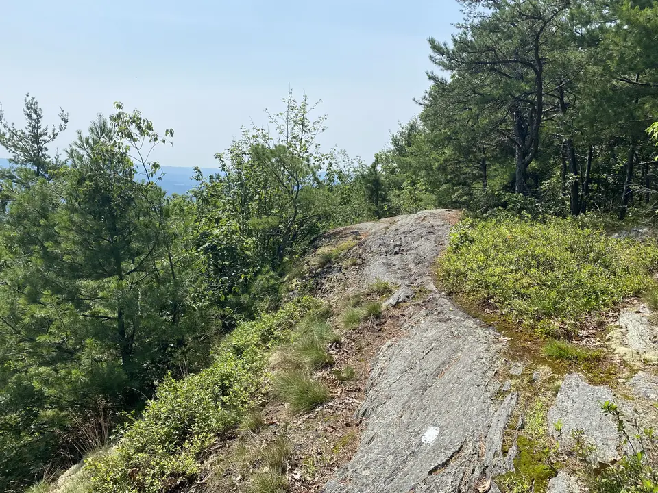
Southbound hikers climb steeply, directly from the parking area, then the Trail levels out slightly on a modest bench. Passing a giant boulder that likely dropped off the cliff that is about to be climbed, hikers work their way up steeply on rock steps and narrow, rooty trail with occasional switchbacks. Several times a year, hikers are injured by slipping or missteps on this section-especially when going downhill. Use caution. After about ¾ of a mile of strenuous climbing, the Trail comes out of the woods onto exposed, sloping bedrock, offering a spectacular view eastward across the valley and north as far as Mount Greylock.
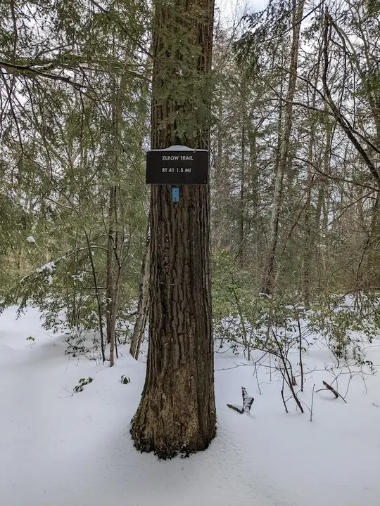
Turning sharply left, the A.T. bends back above the viewpoint and scrambles on more ledge to gain the full height of the ridge. Limited views are still available through stands of pitch pine. Eventually, the Trail turns south for good, re-entering woods dominated by oak and mountain laurel. This section of the Trail is also spectacular when the laurel is in bloom in late June. Continuing through the woods and on bedrock outcrops, some of them quite steep for short distances, the AT stays on the ridge with only occasional limited views to the east. It reaches the blue-blazed Elbow Trail at 2.8 miles, which leads steeply down to private Berkshire School, who maintains the trail. Hikers wishing to park at the school should obtain permission.
Turning sharply right at the Elbow Trail, then shortly turning left again, the A.T. steadily rises moderately over many water bars (drainage ditches) before descending again and arriving at blue-blazed access trails to Glen Brook Campsite and Hemlocks Shelter at 3.5 miles. These two adjacent overnight sites are primitive camping areas for A.T. backpackers, but can make a nice lunch stop.
Climbing again, the Trail scrambles over more bedrock before finally leveling out for the last bit before the parking area. The blue-blazed Guilder Pond trail junction offers the opportunity to circumnavigate this beautiful high-altitude pond; the trail will lead back to the main access road which leads left to the parking area. The A.T. continues on a short distance before reaching the Guilder Pond parking area at 4 miles (and a lot of climbing) from Jug End Road. Note that there is a gate at the bottom of the access road, about 0.8 miles from the parking area. This gate is closed in the winter, and overnight in the summer season. Hikers, skiers and snowshoers are welcome to come in from the gate all winter.
The Appalachian Trail (or A.T.), is a 2100 mile footpath stretching from Maine to Georgia. 90 miles of the Trail are in Massachusetts, traversing the Berkshires. Local volunteers manage and maintain the footpath and the surrounding trail corridor in partnership with the Massachusetts Department of Conservation and Recreation (DCR) and the National Park Service Appalachian Trail Park (NPS-APPA). While popular with both day hikers and backpackers, the A.T. is managed as a primitive backcountry trail with limited amenities. Visitors should dress for the range of expected weather, wear sturdy shoes, and carry the Ten Essentials on their hike. Bicycles and motorized vehicles are not permitted on the A.T. For more on the Appalachian Trail, visit the Appalachian Trail Conservancy’s website.
Massachusetts Department of Conservation and Recreation
Mount Everett State Reservation
Tell others about this place
The Appalachian Trail intersection with Jug End Road contains a small dirt pull-off to the side of Jug End Road that contains parking for 5 cars. Both sections of the Appalachian Trail begin from the trailhead with sustained slopes of at least 25%, with the northbound section starting a lengthy, rocky climb up to Jug End. The southbound section quickly flattens out, remaining flat for miles.
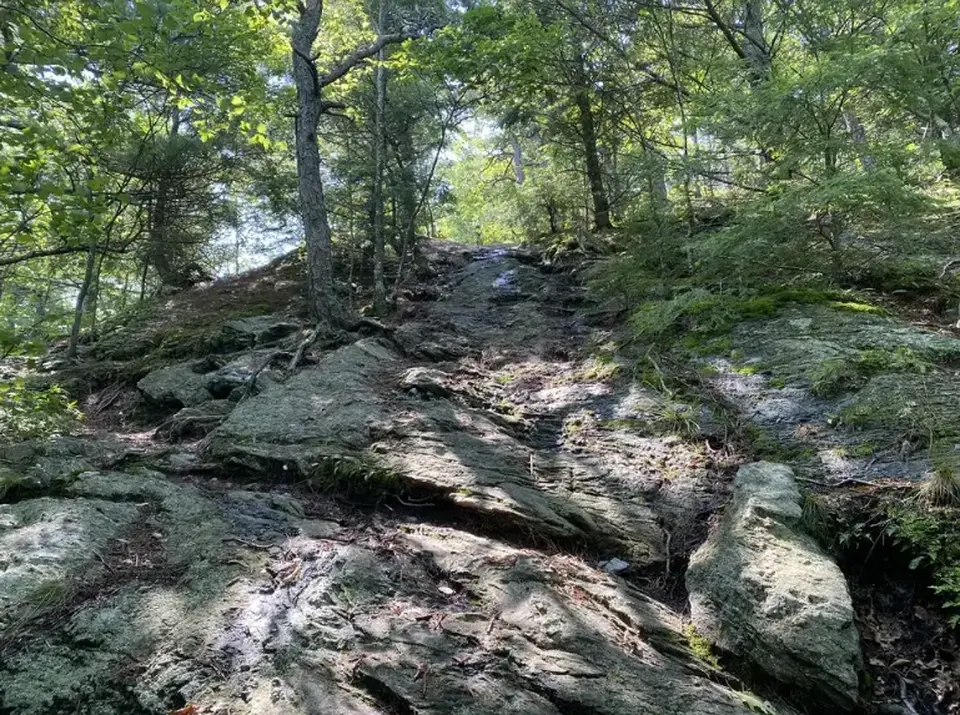
A particularly steep and rocky section on the Appalachian Trail close to the trailhead
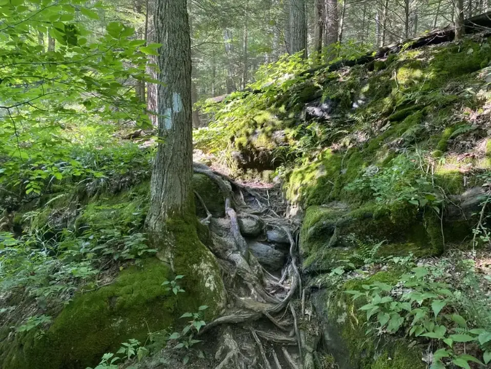
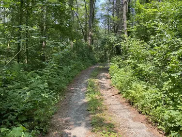
A narrow section of the trail surrounded by mossy roots and rocks.
Looking to meet up with others for team sports or group activities? Check out our list of clubs, guides and leagues in the Berkshires on the Resources page. Our list of summer camps will help you plan an overnight or day camp adventure for your young ones.
We also link to an array of outdoor recreation retail shops for gear and rental facilities for equipment on the Gear page.