Appalachian Trail Trailhead - Jug End Road
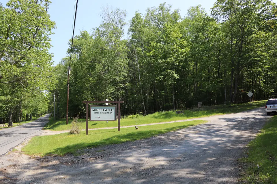
Mount Everett State Reservation
Egremont, MA
Snowshoeing | Hiking | Camping Utilities
Massachusetts Department of Conservation and Recreation
Mount Everett State Reservation
Allowed Uses & Features
Information
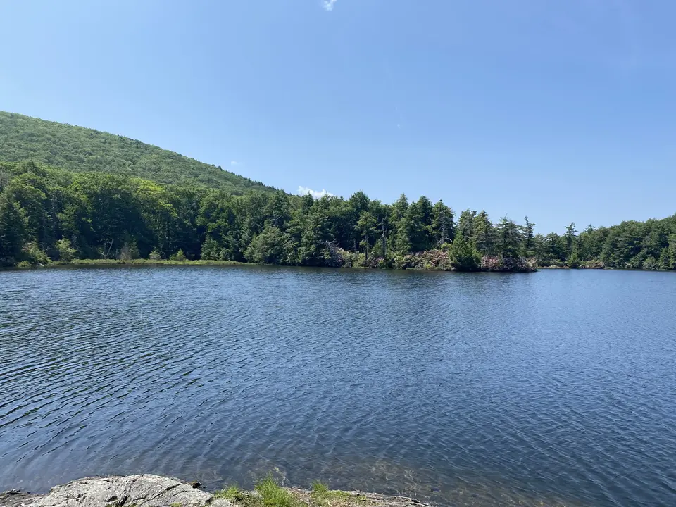
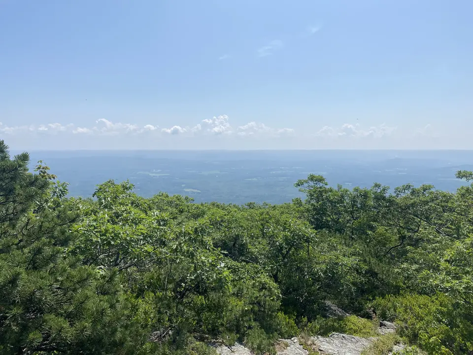
Guilder Pond, with a view of the Taconic Mountains in the background.
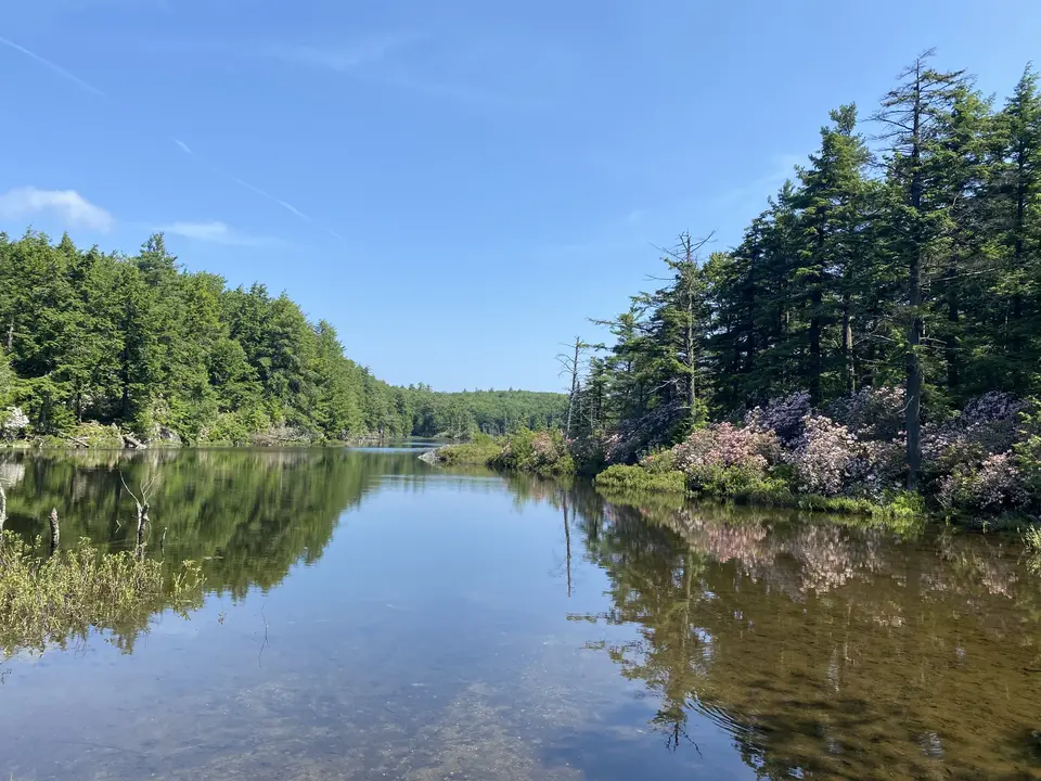
Guilder Pond.
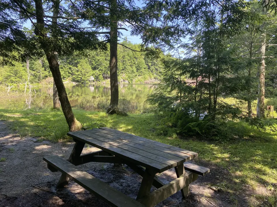
Picnic area next to guilder pond accessible by trail or a small pullover from the road.
Picnic area at the Mount Everett lean-to scenic area.
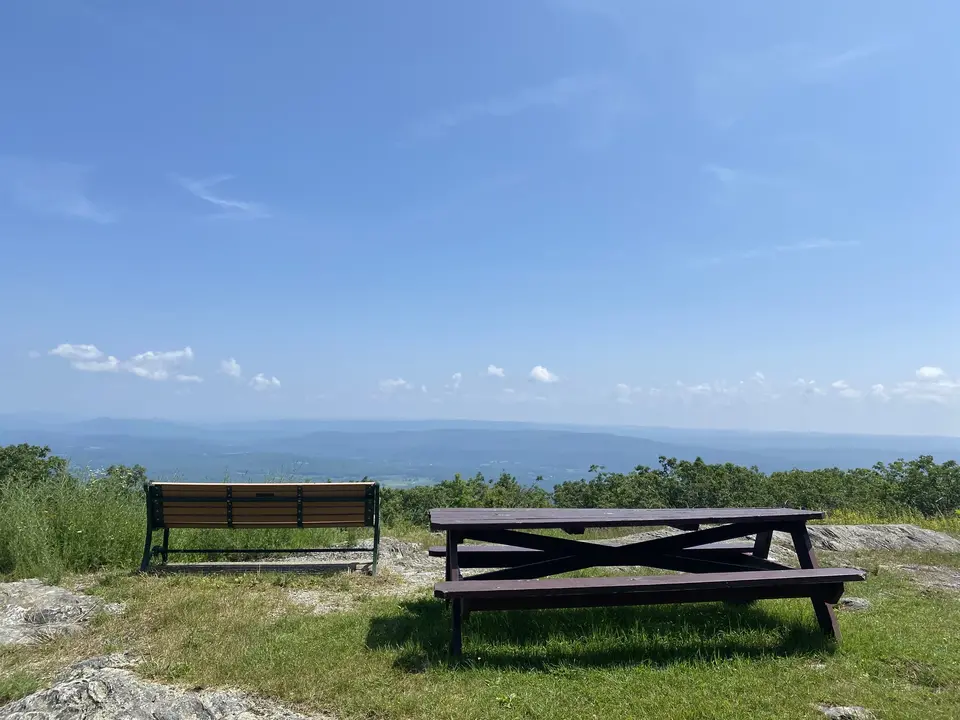
Mount Everett scenic lookout facing east.
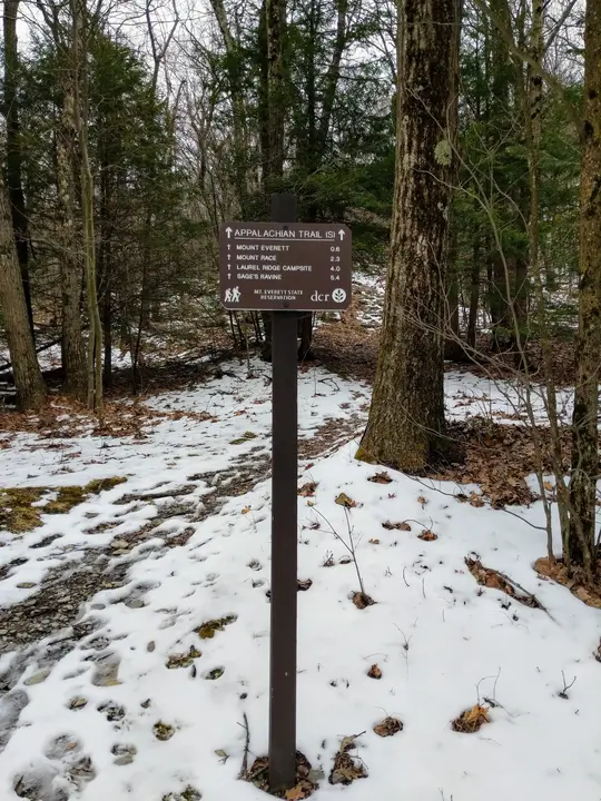
Appalachian trail intersection with the guilder pond trailhead.
Allowed Uses & Features
Information
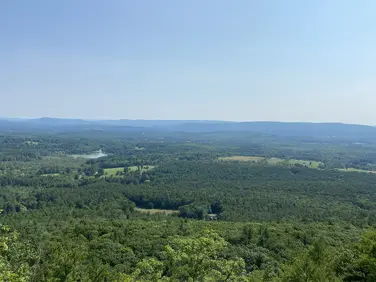
Guilder Pond is a boating and hiking area in Mount Everett State Forest. Visitors will have many options for an enjoyable day of outdoor recreation in Western Massachusetts. For a short hike, visitors can head southbound along the trail and hike to the top of Mount Everett, which features expansive scenic views of the surrounding Berkshires. There is also a lookout with a bench and a picnic table at the end of Mount Everett Road. In autumn, this is an excellent place for a family-friendly picnic. The forest’s leaves often burst with the oranges and yellows of fall foliage.
The pond itself, meanwhile, provides additional scenic views. In early June, the area is covered with mountain laurel blooms. On the north side of the pond, visitors will find a place to swim on hot summer days. Then, picnic tables surround the pond and offer ample space to relax. On the south side of the pond, there is also a boat launch for canoeing and kayaking. Visitors can go fishing and watch the ripples reverberate through the water.
There is a parking lot near the top of Mount Everett Road, open until 8:00pm. The road is typically closed during the winter and early spring. During the winter, visitors can park at the lower Mount Everett Road parking lot and reach Guilder Pond after a 0.8 mile hike up the gravel road.
Northbound hikers of the A.T. can spot a 2nd car at Jug End Road, for a rugged 4 mile hike. Southbound hikers can set up a similarly rugged 3.5 mile hike (though mostly downhill) with a car at the Race Brook Falls Trailhead on Rt 41 (Undermountain Rd). For an additional challenge, Southbound hikers can add a 3 mile out and back for fantastic views from Mt Race, before descending on the Race Brook Falls Trail. Note that while listed mileages are relatively short, these sections of the Appalachian Trail are quite rugged, and the elevation changes can make for a challenging day. There are limited opportunities to shorten your hike, as the A.T. traverses the ridgeline and tops of the mountains.
Northbound hikers leave the parking area towards Guilder Pond. Shortly, a blue blaze side trail departs to the left. This 0.7 mile trail circumnavigates this beautiful high altitude pond and returns to the parking area via the access road. Continuing northwards, the A.T. descends steeply, reaching the Hemlocks Shelter and the nearby Glen Brook Shelter and Campsite after about 0.5 miles. These are primitive overnight facilities for A.T. backpackers.
Leaving the overnight sites, the Trail climbs steadily, then descends, turning sharply right, then shortly, sharply left. At the 2nd turn, the Elbow Trail descends steeply to private Berkshire School, who maintains the trail. Hikers wishing to park at the school should obtain permission.
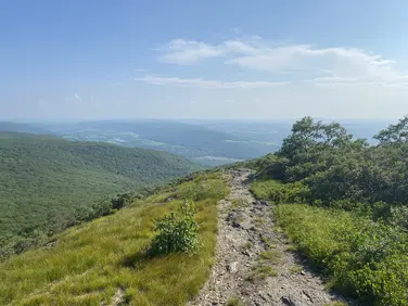
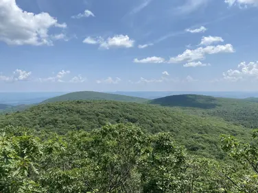
Continuing on occasional bedrock outcroppings, with limited eastward views the A.T. passes through dense laurel, which blooms spectacularly in late June. After about 3 miles, the Trail breaks onto the open ledges of Jug End. Traversing through clumps of pitch pine the route descends to an expansive, exposed overlook where Mt Greylock can be seen on the distant northern horizon and the broad Housatonic valley is laid out to the east. Descending steeply on rocks and wooded ledges for another half mile, the trail reaches a level area before descending abruptly to Jug End Road at 4 miles. Note that this route is slippery in wet weather and hikers should use caution and proceed carefully.
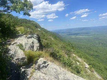
Southbound hikers depart the parking area behind the large “Appalachian Trail” sign and begin climbing, soon reaching a portion of the access road that is closed to all but emergency vehicles. Crossing the road, the A.T. continues to climb, in places steeply on rock steps. At 0.4 miles, it reaches the corner of a small field on the left which leads to an expansive view to the north. There is a stone shelter at the site, which is not open for overnight use. Continuing to climb, the Trail curves slowly to the right, skirting the summit of Mt Everett before climbing up directly. Before the summit, look right for a blue blaze that indicates access to a large bedrock outcrop--views from here include Mt Greylock on the northern horizon and the Housatonic valley spread out to the east. An excellent stop for a snack. Continuing on the A.T. another 300 feet, the Trail reaches the summit of Mt Everett at 0.7 miles. Views are limited. The concrete foundations of a fire tower remain at this location.
The A.T. bears left at the summit and traverses a relatively level, if rocky, area of dense pitch pine. This is rare habitat for Massachusetts, only found on Jug End, Pine Cobble in Williamstown and on Nantucket Island. Soon the Trail descends steeply, occasionally on wooden blocks on the larger areas of exposed bedrock. Use caution, especially in wet weather. This is prime habitat for the Eastern Diamondback Rattlesnake, stay on the Trail and avoid walking through the brush.
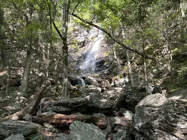
The descent moderates and crosses the sources of Race Brook. The signed blue-blazed Race Brook Falls Trail is reached at 1.6 miles on the left. If including Mt Race on your hike, continue on the A.T. climbing several bedrock outcroppings before finally reaching the summit 0.8 from the trail junction. Views are limited here, stay on the A.T. for another 0.5 miles for very expansive views to the east. Use caution, as the Trail skirts the top of a tall cliff in places. Returning to the Race Brook Falls trail: this two mile trail descends past the Race Brook Campsite, a primitive overnight site for backpackers, and follows Race Brook before turning sharply left before descending steeply to cross the brook below the upper Race Brook Falls. This waterfall is spectacular in the spring and the unbridged crossing can result in wet feet. Race Brook Falls trail continues to descend, steeply in places, with additional side trails to the lower falls before reaching the trailhead at Rt 41 (Undermountain Road) 3.5 miles from Guilder Pond.
The Appalachian Trail (or A.T.), is a 2100 mile footpath stretching from Maine to Georgia. 90 miles of the Trail are in Massachusetts, traversing the Berkshires. Local volunteers manage and maintain the footpath and the surrounding trail corridor in partnership with the Massachusetts Department of Conservation and Recreation (DCR) and the National Park Service Appalachian Trail Park (NPS-APPA). While popular with both day hikers and backpackers, the A.T. is managed as a primitive backcountry trail with limited amenities. Visitors should dress for the range of expected weather, wear sturdy shoes, and carry the Ten Essentials on their hike. Bicycles and motorized vehicles are not permitted on the A.T. For more on the Appalachian Trail, visit the Appalachian Trail Conservancy’s website.
Massachusetts Department of Conservation and Recreation
Mount Everett State Reservation
Tell others about this place
Guilder Pond Trailhead can be accessed around a mile down Mount Everett Road. Both the road and parking lot are a mixture of gravel and dirt. The lot is smooth and compact, and on a small hill. The portion of the Appalachian trail that intersects the parking lot is moderately steep, especially heading toward the Mount Everett scenic overlook. The .6-mile Guilder Pond loop is relatively flat but has sections with roots and rocks. Additionally, the ramp allowing water access is made up of even gravel.
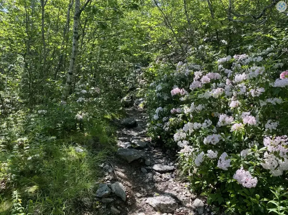
A portion of the Guilder Pond trail.
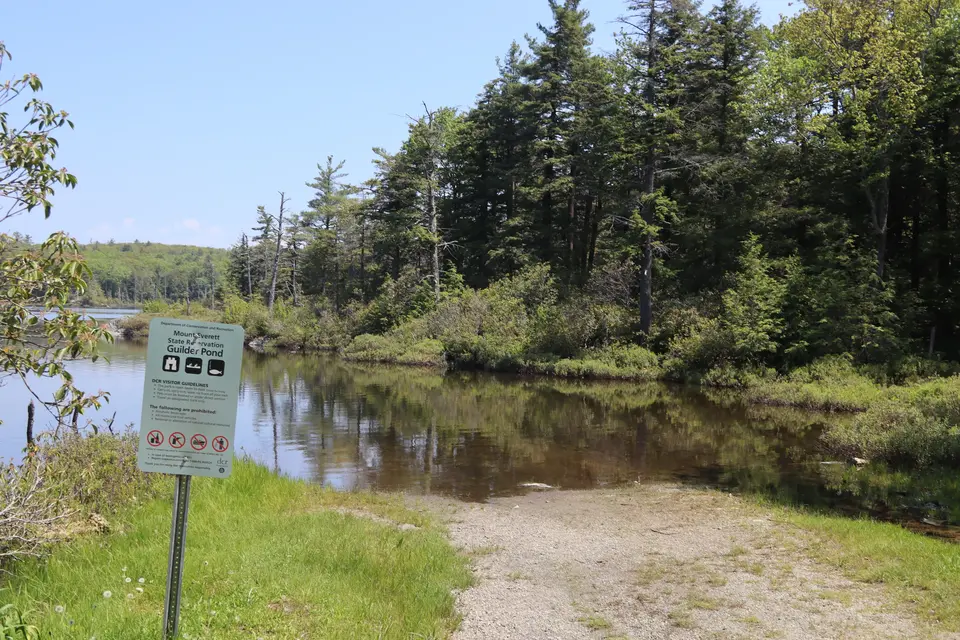
Water access to Guilder Pond. Guilder Pond is open to fishing/kayaking only, no swimming is permitted.
Looking to meet up with others for team sports or group activities? Check out our list of clubs, guides and leagues in the Berkshires on the Resources page. Our list of summer camps will help you plan an overnight or day camp adventure for your young ones.
We also link to an array of outdoor recreation retail shops for gear and rental facilities for equipment on the Gear page.